NICHOLAS HEATH’S EXPEDITION FROM WEST TO EAST
It was a simple plan. Fly across Australia from the westernmost to the easternmost airport on the mainland. Ok, so that would involve crossing the Nullarbor and the Great Victoria, Gibson and Simpson deserts. Plus the adorably named Little Sandy Desert. In a light aircraft. By myself. In 10 days. See? Simple.
Many years ago, I read a book by the Leyland Brothers about driving from the easternmost to the westernmost part of the Australian mainland called Where the Dead Men Lie, a title taken from a rather creepy Barcroft Boake poem. They managed to traverse this centre line across the country in a few Land Rovers with 1940s technology. I should have no trouble in a plane with an engine based on… 1940s technology.
But I would have modern navigation. GPS. Modern flight planning tools. And an autopilot. Fortunately, flight planning for these long trips is a bit of recreation for me. I often sit there with OzRunways, plan flights and look at airports just for fun, like an armchair traveller with an atlas. The hardest part would be finding places to refuel with suitable accommodation. Pretty soon I realised it would be better to choose overnight stops and pick up fuel along the way.
Try not to die out there…
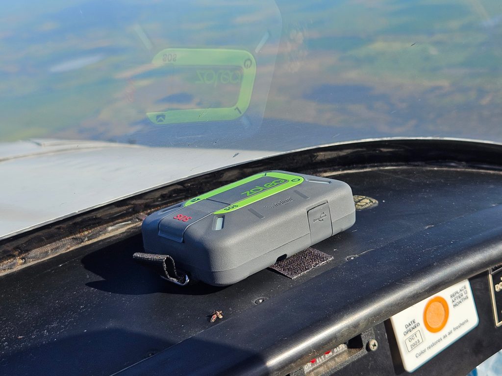
Before you set out across the vast unknown, it’s probably a good idea to make a few preparations. I know there are people who fly across remote Australia in small planes every day without a second thought, but that’s not me. I approached this whole trip with an abundance of caution. First up, I packed my underwing camping gear. Chances were I might have to camp a night or two anyway. Then food and plenty of water, enough for 3 days. On the comms front, I added a ZOLEO which permits text and email via satellite, a welcome addition that would keep me connected throughout the journey. I still had the EPIRB from when I went up to the edge of New Guinea last year. Throw
in the first aid kit, tie down set and extended tool kit, then try and solve the weights and balances. Overkill? Maybe. But I was literally crossing the Nullarbor, the Gibson and the Simpson Desert. Packing it in the plane required me to strap two bags into the passenger seat for space and balance reasons. Not forgetting I was carrying a 45L long range tank in the back of the aircraft, which chewed up most of the baggage area weight allowance when filled. But it did give me 180 litres. At 30 litres an hour, that was 6 hours at 150kts. Say 750nm with an hour up our sleeve.


FRIDAY: AS THE CROW FLIES…
The direct route from home base in Lethbridge in Victoria, to Forrest in WA would put me way, way out to sea. I have an aversion to being out there in the Southern Ocean in a single-engine aircraft if I don’t need to be, so I cut the corner so-to-speak and headed for Port Lincoln as a fuel stop.
The weather was, well, Victorian. Patchy cloud. Showers. Generally crappy, but getting better as I headed northwest. After take-off in Lethbridge, by the time I had got everything arranged to my satisfaction and had a look through my plan I was already at the coast just north of Kingston, SA. Time flies when you’re… flying.
The track took me just north of Kangaroo Island and Kingston. If you haven’t been there, go. It’s glorious. Unfortunately, the weather that day was still more cloud than not. The planned stop at Port Lincoln was quietly shelved in favour of Ceduna where the weather looked a lot nicer. Clearing Coffin Bay, the weather cleared and I was rewarded with a superb view along the Bight with visibility to the horizon. At 6500 feet, that’s about 100 miles. Ceduna was visible a long way off with the grain silos at the wharf prominent. Here’s my list of what I like about Ceduna: It has fuel. It may be the nicest place in the world, but I wouldn’t know, because I fuelled up and buggered off. Back in the air I climbed to 8500 to take out the afternoon bumps and more importantly to cool down. The head of the Bight (the northernmost point) was very prominent and came up as a big sand patch that I could see from maybe 50 miles away. From there it would be inland and I wouldn’t see much water until the Indian Ocean.
As I crossed the South Australian border, I gained half an hour. As I then crossed the Western Australian border I gained another 2.5 hours – them not being on this newfangled daylight savings – so it was middle of the day local time when I arrived at Forrest, WA. Forrest is the last surviving stop on the Indian Pacific train route from back when the trains needed to stop for coal and water. It extended its life as an airline stopover and meteorological base into the 1990s, but now it’s home to one permanent family who manage the place and some houses for passing 4WDers, pilots and the occasional prospector. It should be on your flying bucket list. Whoever named Forrest must have been some sort of comedian, because it sits smack in the middle of the Nullarbor, which is Latin for “no trees”.
I was looked after well, given a vehicle to drive around, not that there was anywhere to drive to other than the half-mile from the hangar to the house. They also had AVGAS on tap. Not cheap, but you can’t really argue when you’re this far from a refinery. The plane even got a spot in the hangar out of the sun and wind. Spoiled! I spent the afternoon wandering the old weather station which has been preserved as a museum. A freshen up, followed by a home-cooked meal on the veranda and in bed very early. My body clock said 8pm was 11pm.
SATURDAY: OUT OF THE FORREST
I’m not known as a morning person. In fact, very few people are brave enough to talk to me before I’ve had a coffee and a moment to compose myself. But for the next few days I would be Mr. Up-And-At-‘Em, courtesy of the time zone differences. At 6am I rolled out of bed, munched some thoughtfully provided breakfast, carefully stowed my gear and an equally thoughtful supplied packed lunch, headed to the hangar and, not much after 7am, I was in the aircraft and rolling. Nice.
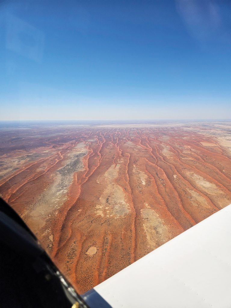
The next planned stop was Leonora, a small mining town. Actually, in WA you can probably delete the words “mining town” as being redundant. I think they might all be mining towns. The noticeable thing about this leg – which covered some Nullarbor and Great Victoria Desert – was the huge amount of nothing out there. I mean nothing. There was red, and occasional clumps of bushes. Turns out the Great Victoria Desert – which I hadn’t ever heard of – is the twelfth largest desert in the world. And the Great Australian desert – the collective term for all of the aforementioned deserts – is the fourth largest after the Antarctic, Arctic and Sahara.
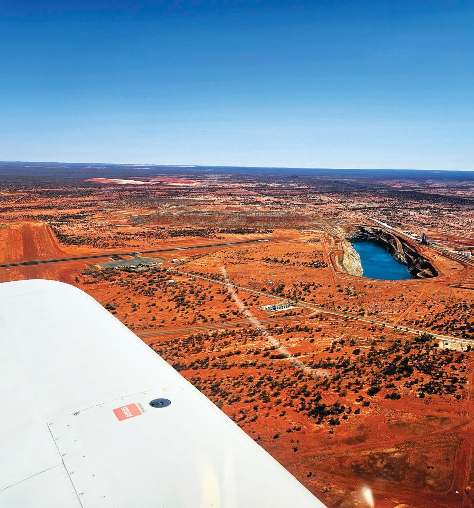
I had checked there would be fuel available at Leonora, all I had to do was call a number. Joining the circuit, the first thing you notice is the monstrously large pit that you will end up in if you land short. This thing looks like the entrance to hell. I may have landed a tad long, but there was oodles of runway to play with. I pulled up near the terminal and called the fuel number. Then the next number. I left a message but no reply. In fact, I’m still waiting for that call back. I found the fuel. Lovely drums of it… in a locked shed. Fortunately, I had brimmed tanks at Forrest. A quick recheck of the ERSA, and a phone call revealed that Meekatharra was my best and possibly only option en route. I was planning to go there on the return journey anyway, but now I would have to replan.
All that fuel and not a drop to drink…
I had spent the night before at Forrest talking to a couple of prospectors who were searching for some magnetic anomaly in the middle of the Nullarbor. They said getting to Meekatharra would take them 2 days driving. About 16 hours. It took me three and a half hours with a small tailwind. Kinda underscores the value of an aircraft in this country.
Landing and refuelling in Meekatharra were as per the WA script. Hot? Check. Big pit nearby? Check. Fortunately, there was a very pleasant air-conditioned terminal and clean bathroom. A big thumbs up there. Next stop, the Indian Ocean.
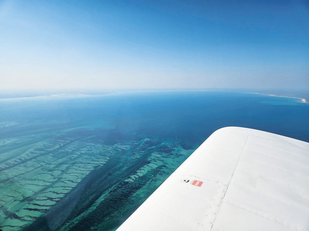
That last hour in the afternoon in WA was some of the bumpiest crap I’ve ever ridden through. It didn’t seem to matter how high I went, it just sucked. Fortunately, about half an hour from the coast, it smoothed out as I came into the influence of the Fremantle Doctor – the universal WA sea breeze that brings relief. The last part of the journey saw me cross the coast to land on the isthmus on which the coastal town of Denham sat, and the Shark Bay Airport – the westernmost airport that you can use on the Australian mainland. Did I mention it was hot? Yup. Still warm on landing but so glad to get back on the ground after a bumpy approach. You don’t need to be Sherlock Holmes to find the tie downs here, but it would help. Sneaky recessed metal loops. Hard to see when taxiing. But they worked a treat and they would need to, as a 25-knot sea breeze in the afternoons seemed to be the norm. A well tied down plane and a quick call to my accommodation at Denham – the Heritage Resort on the waterfront
– saw no less than the manager arrive to pick me up. The P.O.S.H. travelling life for me. It’s actually a very nice spot, overlooking the waterfront with a bar and dinner. I was set for the next two nights as Sunday was designated as R&R. Just as well, because I was stuffed.
There was a bonus to landing at Meekatharra on the way in. Because it was further west, I would now be able to go to the coast and back without having to duck up to Carnarvon for fuel. The very pleasant experience of staying at Forrest made me realise how much I liked small outposts. A search online found stations you could stay at and I spoke to Carnegie Station and organised a bed for Monday night. Plus, I was finding it very hard to get accommodation in Uluru, so I would just fuel stop there and stay at Mt Dare Station the next night.
MONDAY: SHARK BAY TO CARNEGIE STATION
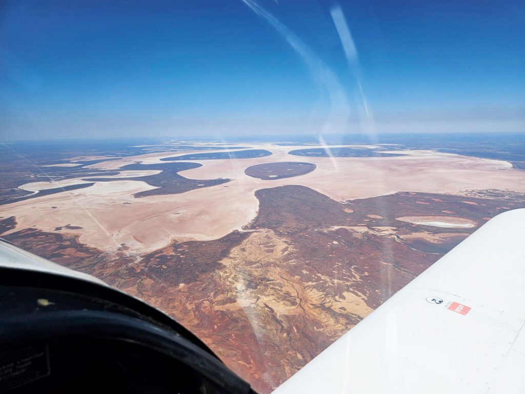
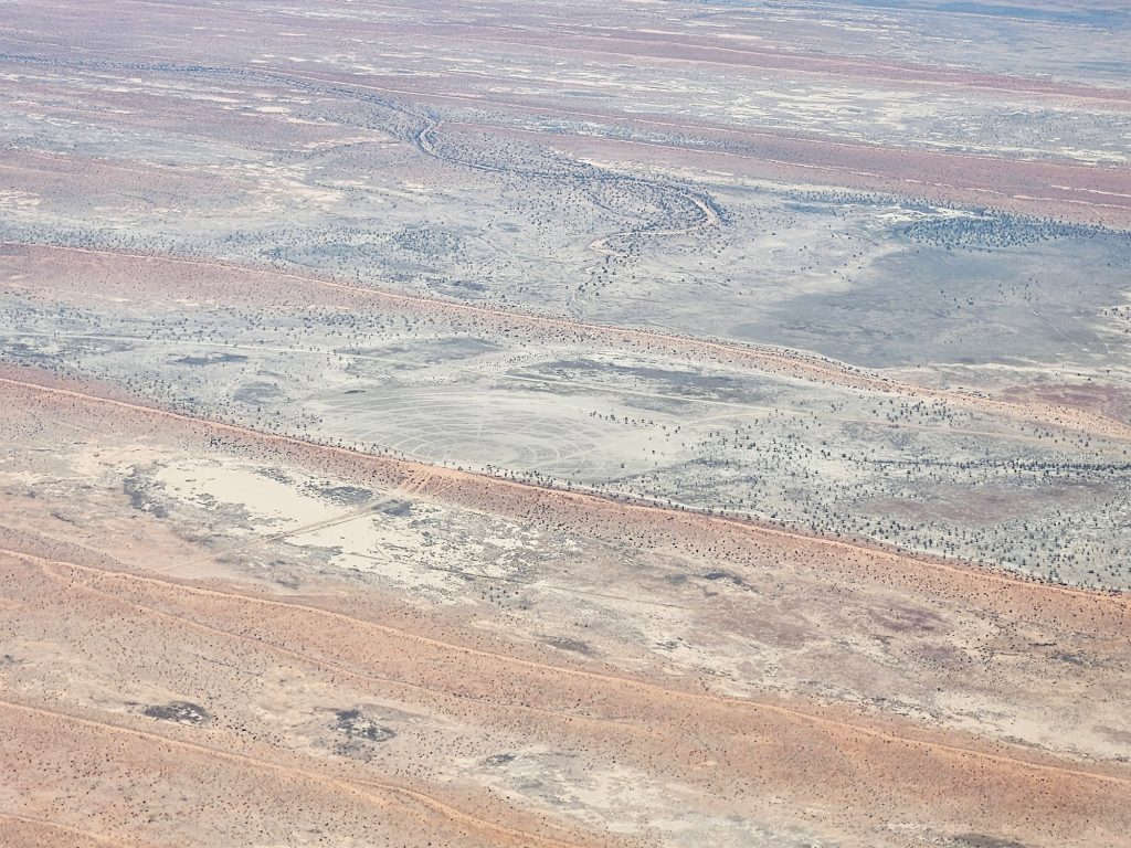
Today I would be starting the west to east crossing and I was a little bit daunted. That’s some remote stuff out there and I’d never been to any of these airports. Perfect. Clear Prop! The return trip to Meekatharra was an easy and smooth reverse of what I had experienced two days before. Other than my start/finish point, this was the only airport I would visit twice. Came in like an old hand. Fuel, water bottle fill and gone again. After Meekatharra, the settlements get very sparse. Within an hour I was just flying over open plains with the occasional station homestead on the map. There ain’t a lot else out there from 8500 feet. But lo, on the horizon! A big white thingy. Turned out to be Lake Carnegie. All 5700 square kilometres of it. But (and call me fussy here) there wasn’t a drop of water in it so… lake? Not really. But a great visual cue as to where
Carnegie Station might be, right? Wrong. It was way past there, like 50 miles. God bless GPS, because dead reckoning to this location would be hard.
I began a descent and fair roared over the homestead as instructed before circling back to the strip. It’s a great big graded thing with lots of little shrubs sprouting from recent rain. No problem, left, left, and on final. Airspeed good, descent good, flare, let it sink and BOING! We bounce way back up. Ok, let it settle again and boing! Back up again. By this point the end of the runway and the strip looked pretty bushy down the end there and thought “Nope. Let’s try this again.” Throttle in, pitch up, flaps up slowly, climb away. The second time I landed a little longer because that first couple of hundred metres had lost my trust. No problem. You know how I said I only visit one airport more than once on this trip? Put me down for two.
A station hand had been sent out to get me. I apologised for the delay caused by the go-around, he responded laconically, “yeah we probably need to grade that again”. Good to know.
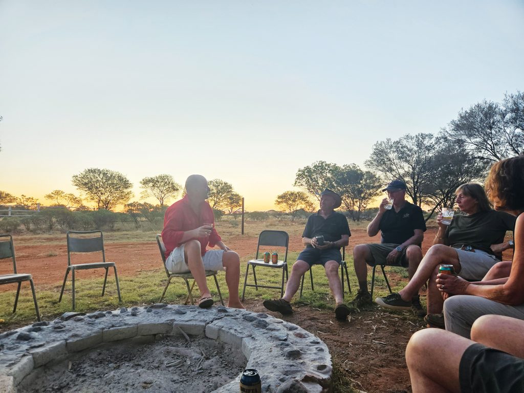

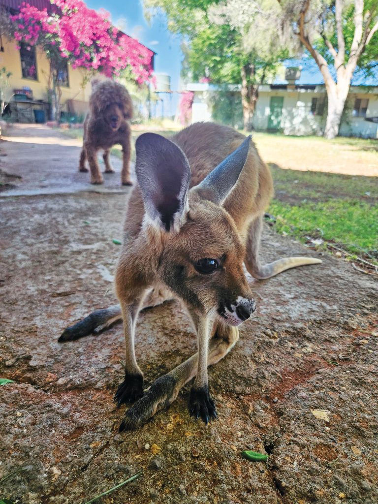
Carnegie Station is an oasis at the start of the Gunbarrel Highway – the road that crosses the Gibson Desert, made famous in Len Beadell’s books. Read them, they’re great. The musterers quarters provided donga style accommodation, a large kitchen/dining area/social hub and a store in the centre. Rustic, but that’s the vibe of the thing. All I knew was the station beef roast cooking smelled fantastic and proved to eat just as well that night. Joey, the orphan wallaby, adopted me and followed me around for my stay – including into the shower. A convoy of three vehicles pulled in and joined us for dinner. They were retired couples with LandCruisers and camper trailers headed across the Gibson to Warburton over the next three days.
They asked me when I would get to Warburton. I said about 8:30am if I left at 7pm. Hehe.
Carnegie Station and its associated pastoral leases are enormous – about 1.2 million hectares or almost 5 times the ACT. With 20-odd thousand cattle walking around, they have a similar amount of bull, too. The station hand told me the next morning that he was going to check the water down south today, a round trip of “about 300kms” for he and his dog. I left him to it.

TUESDAY: DOWN THE GUNBARREL
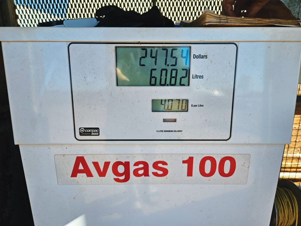
As I climbed out from Carnegie Station, I headed into the Gibson Desert proper. Weirdly, there were more features today than in yesterday’s coast to Carnegie trip. I didn’t know how many massive rock formations were out there. You know those days flying when you just sit back and get awestruck by the beauty? This was one of those days. Just as well, ‘cos it was going to be a long one. I was loosely following the route of the Gunbarrel Highway and I paused to think about those people blazing the first tracks through here. In the middle of this ancient landscape sits Warburton, an indigenous community which has a very nice airstrip and, more importantly, fuel. And not only that, driveway service! I guess at $4 a litre you get those sorts of benefits. So, while the very kind operator refuelled my plane I made my way to the facilities, passing under the
Warburton International Airport sign. I didn’t see many international flights, but I wasn’t there very long, so who knows? Fill, empty, and roll again?
My inflight catering was getting a bit thin, so it was mostly Le Snak’s until dinner. Maybe there would be something at Ayers Rock? I say Ayers Rock and you’re probably thinking “Tsk, tsk, it’s called Uluru now” and you’re right, but the airport is still called Ayers Rock. Anyhoo, I had learned that there was a purple dots route that took you over to Uluru, around Kata Tjuta and back to Ayers Rock (the airport). Plus, because it could get pretty busy, they have a CA/GRS, which turns out to stand for Certified Air/Ground Radio Services. Think of it as Air Traffic Control Lite. You tell them what you’re doing, they tell you what’s going on but they don’t tell you what to do. Sort of. I hope that clears that up.
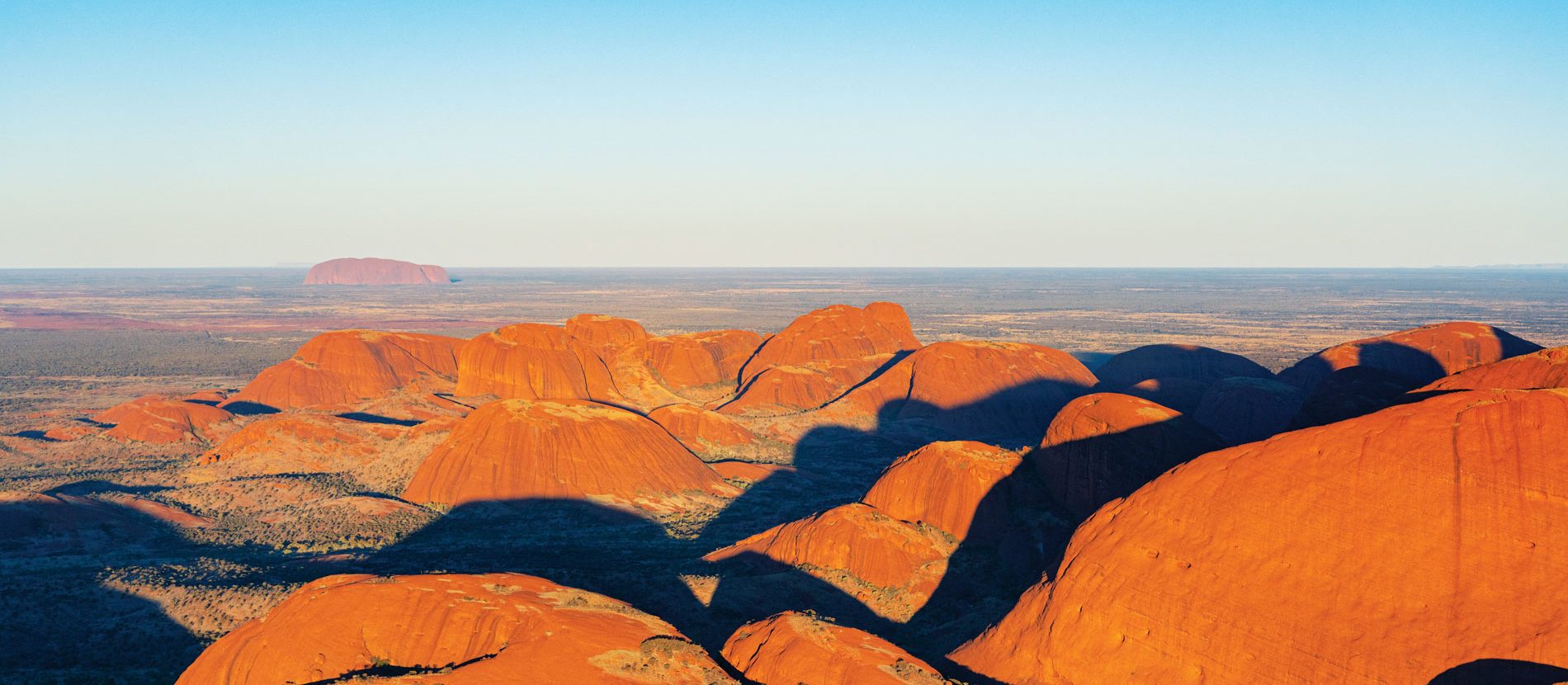
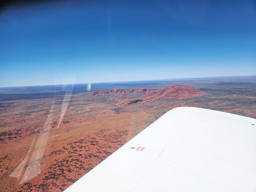
Kata Tjuta came into view on the horizon. I have walked through it. In many ways, it’s more interesting than Uluru at ground level, but as it came into view there was no denying its iconic status as the heartstone of the country. It’s iconic, and I felt privileged to be seeing it from up here. Of course, I would have felt even more privileged if I hadn’t been bouncing all over in the midday turbulence under 5000 ft. On the ground, I made my way to the bowser and for the first time ever was carded for an ASIC. I felt pretty smug as I was wearing my hi-vis vest and had my ASIC clipped on – mostly because it has the fuel card at the back, but anyway. I decided to skip the whole find-a-park-and-schlep-to-the-café, favouring another Le Snak and half a bottle of lukewarm water before heading on to Mt Dare station – tonight’s destination.

Time was against me. As I headed east, I had lost 3.5 hours on the clock. Climbing back above the bumps, I headed southeast to intercept the SA border an hour and forty minutes later. Then I was descending to Mt Dare. On the way I passed Mt Conner, just south of Curtin Springs, which looks a lot like that mountain from Close Encounters of the Third Kind. Spooky. Approaching Mt Dare I saw a huge and inviting landing strip on the east side and didn’t mess about landing it, taxiing, and getting gear out. Turns out I was at the wrong runway. Mt Dare has a second runway slightly closer to the house but the two don’t intersect. Don’t be tempted to taxi along the road to the other runway, if this happens to you as this is illegal. Just as well, because the wind picked up at dusk.
Mt Dare sits at the edge of the Simpson Desert and marks the western end of the crossing for most. There’s a big shed that serves as a bar, restaurant, shop, and community hub, they call it the Mt Dare Hotel. Then there’s a bunch of portable cabins, the homestead, sheds and camping spots on the perimeter. I had been allocated a primo portable and I was very happy with that. I was also very happy with the cool drink. While Mt Dare is officially in South Australia, being just 10km from the NT border, it runs on NT time. I had moved from WA time, to NT, to SA, and back to NT time today. I really needed that drink. After a night of good food and company, I was away
again early the next day.
WEDNESDAY: BIRDSVILLE OR BUST
I had originally planned for a rest day at Uluru, but school holidays accommodation shortages meant that didn’t happen. Instead, I put in a short hop to Birdsville with the intention of having a relaxed afternoon catching up on sorting, laundry and planning. Crossing the Simpson was even easier than the last two deserts. Big sections of sparse dunes. Then I saw a weird shape ahead that looked like an alien artifact. As I approached, I realised I was seeing the footprint of the Big Red Bash music festival and the famous Big Red sand dune. I was close to Birdsville.
As always, after an hour of radio silence, my inbound call prompted every person in the district to announce they were on long final. Some of them must have been very long finals, because I landed well before them. The prevailing wind meant that I landed to the east and rolled straight off the runway to the apron and parking area opposite the iconic Birdsville Hotel where I had a room booked. It was maybe 100 metres from the plane to the pub. If they could work on shortening that, I’d appreciate it? I was in time for lunch and it was the first real lunch I had since Sunday.
After a brief sojourn to the roadhouse to replenish the inflight catering supplies, I settled in to plan the next day’s travel. Tibooburra was the next intended port of call. But the weather forecast was for upward of 50km/h westerly winds when I got there. I don’t know if you’ve ever parked on a gravel strip overnight in 50km/h winds, but the peppering stones weren’t going to be good for the plane. I had to come up with a new plan. Those winds extended across most of Southern Queensland/NSW. I eventually spotted that they would be better at Moree in NSW. And they had fuel. And a bed at the Royal Hotel. Sold.

THURSDAY: BIRTH OF THE SPEED DEMON
The only problem was that it was a 600nm leg. In theory, I could manage 650nm provided there was no headwind, but every leg this week had a headwind. The forecast 50km/h westerly gave me hope of not having to divert for fuel. As I climbed out of Birdsville it became apparent that the tailwind would be there. At 7500 feet, with the engine drinking about 28L/hr we were sitting comfortably on 180 or better knots – that’s a 33-knot bonus. I am speed.
I was through this region last year when I flew up to the edge of New Guinea and it was wet all the way. What a change. It was dry, dusty, and burnt all the way across. Not good for the farming types and fire season. Mostly I was just excited to be going fast. As I started my descent the groundspeed touched 200kts. Stuff happens quickly at 200kts. I was almost half an hour ahead of schedule as I came in over the piano keys. There was stiff three quarters on crosswind, so half flap, but close to the ground it wasn’t too bad. Parked, locked up for the night and got a cab into town. Moree is like you called central casting for a big country town. Big wide streets. Classic pubs. The Royal had redone their rooms but it was still classic Aussie pub style. Bathroom down the hall, breakfast room on the right.
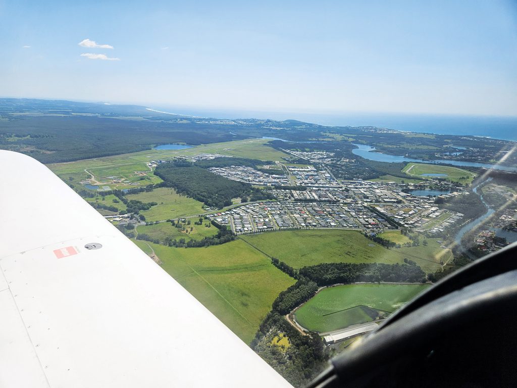
FRIDAY: SEA TO SHINING SEA – BALLINA AND COASTAL TO YAMBA
Today’s planning meant that we had to thread the coastal needle of red zones and controlled airspace to end up at Ballina – our easternmost destination – where there is a Mandatory Broadcast Area, overseen by Airservices. After having the skies mostly to myself for the last week, I would have to start getting my head back into traffic and controlled airspace. OzRunways showed me exactly where I was in relation to the red zones and what was active. Kudos to all you people who navigated this stuff by dead reckoning with an E6B. I’m glad I don’t have to.
Tracking as I was, I flew in over Casino and Lismore, keeping a little south for courtesy and clearance before having to descend fairly smartly into Ballina. The Pacific Ocean came into view and I was very pleased to see it. That Indian Ocean is all very well if you like that sort of thing, but give me the Pacific any day. A quick chat with the Airservices controller revealed it was mostly quiet and I had just one other aircraft to contend with. I landed on 24 which made for a short taxi to the GA area. Oops, wrong turn ended up in the RPT apron. Naughty. Beetled across to the GA area. And another first – had to hold at the refuelling bowser to permit a helicopter to taxi beside
me. And by taxi, I mean hover just above me and to the right. Windy. Very windy.
I took a moment to bask in the fact that I had done it. Westernmost to easternmost! But it wasn’t an extensive bask, because I had decided to jump down to Yamba for the night as I had family holidaying there. A very relaxed coastal cruise of less than 20 minutes past Evans Head (most of which was taken up with the mandatory calls to the Airservices controller. “Hi, how are you?”, “What are you wearing?”, “Sounds nice”, etc.) found me peering ahead looking for Palmers Island/Yamba Airport. I knew it was there because it was on the map and I had spoken to them to organise access. But when it’s a green grass runway in a field of green grass surrounded by fields, it is kind of tricky. The shed had a windsock though, so that’s a bit of a giveaway. I buzzed over to check it out and joined a downwind pattern. From overhead the runway looked
narrow but on approach I could see there was plenty of width – and a group of people watching me land – so no pressure. I always do my worst landings when someone is watching. And guess what? I greased it on. It was like butter. A landing for the ages. Which naturally I just brushed off as what I always do on unfamiliar strips. I got a nice tie down spot organised between two hangars and finally got to use my heavy tie down stakes which I had been carrying.

Best of all, I would actually have a day off in Yamba! Woot! Yamba is actually an as-yet-unspoiled northern coast town that has great beaches, a good river for the fishos, and warm weather. Plus, great food and a hippie vibe. Yes, I will be back. If you’re looking to do the plan, land, and stay thing, I reckon Yamba is right up there with Agnes Water/Seventeen Seventy as a top destination for an extended break.
SUNDAY: TOMORROW TEMORA… AND THE NEXT DAY
While heading home at the end of an adventure has a certain sadness to it, I was bolstered by the fact I would be stopping at Temora to tour the museum. After a little dodging and weaving to avoid the airspaces on the coast, I climbed up for a very pleasant cruise to Temora over central NSW. The countryside turned green an hour later and continued that way south. Nice to see country that isn’t looking droughty. The price of that was broken cloud and an increasing headwind. Descending into Temora, I realised that was going to be a stiff breeze. An extra-secure tie down was needed. Temora Aviation Museum has aviation-themed accommodation right beside it. I was in Bomber HQ, in the Canberra Room. Nice. The setup was four private rooms with an ensuite each and a central kitchen and lounge. Perfect for the fly-in pilot. Three propellors. Highly recommended.
The Temora Aviation Museum – well, all I can say is if you haven’t been there, go. For any warbird enthusiast it’s a must. The pictures speak for themselves. Two Spitfires. I apologise now for the drool puddle. After a thoroughly enjoyable afternoon I retired to Bomber HQ. While town is a walkable distance away, I decided to eat some of the rations I had packed for unexpected stoppages in the outback. I had some MREs – supposedly ‘Meals Ready to Eat’ and it was pretty good stuff, but the next day I was blaming them for my squirrelly stomach. Turns out I had a 24-hour bug. Between that and the abominable weather down south, I called it at 10am and said no flying today. I booked the room for an extra night and settled down to enjoy all the pleasures of my 24-hour thing.
TUESDAY: HOMEWARD BOUND
The following day I wasn’t perfect but a whole lot better than the day before. Fortified with the thoughtfully provided breakfast, I headed south on the last leg. The weather had turned glorious. Welcome to flying in the south. If you don’t like the weather, come back in an hour. Victoria feels very small after a trip like this. No sooner have you crossed the border than you’re thinking about landing.
It was a tired but happy pilot that finally turned the mags off in front of the hangar back at Lethbridge. 4900 nautical miles. 36 hours of flying over 8 days, plus 3 rest days. A thousand litres of fuel at just over $3k. That’s not counting the cost of accommodation, food, plane preparation or anything else. But you can’t put a price on that experience. Well, you could, but I’m not doing the accounting.
Not that many people get to do what we do. During my life I have had several adventures that stick out in my memory. This will be one of them.