WHAT’S THE FURTHEST POINT YOU CAN FLY TO IN AUSTRALIA? AND HOW HARD IS IT TO GET THERE? NICHOLAS HEATH DECIDED TO FIND OUT THE HARD WAY.
Do you ever finish a journey and think “I wish I could just keep going?” I do. All the time. Every time I see a jet flying overhead, I wish I was on it. Doubly so since Covid. Last year I flew up and around southern Queensland. As I turned south, I was thinking there’s a lot more up there to discover. When I started looking for new adventures to write about, I immediately thought of the rest of Queensland. Then a thought struck me – how far north can you go?
A little bit of investigation with charts followed. The northernmost airport on the Australian mainland is Northern Peninsula, which sits close to the tip of Cape York and services nearby settlements like Bamaga. But Horn Island, just 10 nautical miles offshore is even further north. I hadn’t realised that the islands in Torres Strait are “Australia” for aviation purposes, which then got me thinking about which island airfield in the Strait is furthest north? It turns out that Boigu Island, less than 5 nautical miles from Papua New Guinea, is the northernmost airfield within Australian jurisdiction. If I did it right, I could island hop my way there and the longest over-water leg would be under 20nm. It would be all new area to me, with little fuel available, over water flights, into an area that required permission to enter. No end of obstacles to overcome. Perfect!
A plan was hatched where I would fly from my homebase, almost at the southern tip of the mainland, due north through the centre of NSW and QLD to Boigu Island, before turning back down to fly coastal all the way to Agnes Water near Bundaberg via the Old Station Airshow, where my long-suffering wife would meet me for a week of R&R before returning to the cold and gloom of Victoria. That plan got thrown out the window by the arrival of the winter lurgy/man-flu which laid me up the weekend before intended departure. So new plan: fly straight up to Agnes Water via Old Station, R&R with my wife, then head on north while she caught the commercial flight home. For some reason she was not keen on my plan to visit the most remote airstrips I could find. Any questions in her mind were cleared up when she saw me packing emergency rations and camping gear. Some people have no sense of adventure. My wife’s idea of camping under the stars is 5 of them, with the words “Park Hyatt” just above them. So be it. The new and improved plan was implemented, which saw me wave a lonesome farewell to the better half and launch out of Agnes Water.
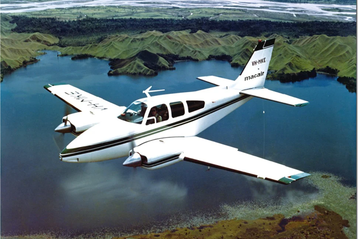
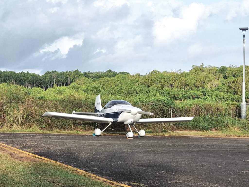
But before we get into the adventure, we probably need to talk about preparation. Our Vans RV6 originally had a long-range tank in it behind the seat, which I’d had removed to free up space. When would I ever need that? Well, turns out, you need it if you’re going to fly remote places. The one smart thing I had done was add autopilot servos to the existing Dynon D10. That would come in handy on the long legs. The team at Horsham Aviation were able to put the tank back in and do a once over of everything the week before departure as I zipped back from a Mildura trip. Thanks guys! Now I had 72 litres each side, plus an additional 40 litres in the back. At my “economic” speed I would be using 28 litres per hour at 147kts. With 7 litres for start up and take off, that gave me a comfortable 5 hours endurance with an hour’s reserve. Say 700 nautical miles for planning purposes – though I would only use those legs seriously once on the trip.
The benefit of being solo is that the saved weight of a passenger would allow me to go full-fat on the luggage. But I would have to be careful with the load out for centre of gravity considerations and balance. Not that I planned on taking a lot of clothing. In that part of the world a t-shirt and shorts were the rule, so minimal packing required. What I did want to have, was enough equipment to deal with things if they went wrong. Call me cautious, but I like to be able to take care of things myself and where I was going, there weren’t going to be many LAME’s or aero supplies. I would have to take it with me. I made up a small tool kit that started with one of those tool roll type kits available in any of the auto chains which I augmented. It had basic screwdrivers, spanners and a plier. I added a tyre gauge, some cable ties and speed tape (as they say in motorsport: if you can’t fix it with cable ties and speed tape, you’re not using enough cable ties and speed tape) a spark plug wrench, an exacto knife and a small wire brush. A puncture repair kit or a spare tyre tube would have been a good idea too. I had a motorcycle can of emergency puncture with inbuilt goo. I hoped that would be enough to get me out of most pilot-fixable issues. You can’t take everything. The next department was camping gear. That would have two major functions. Firstly, I planned to go to the Old Station Airshow. If I couldn’t get accommodation nearby, I was going to be camping underwing. Secondly, who knew where I might have to spend the night if things went wrong and I’d rather do it comfortably and safely. So, in went the sleeping bag, bivvy bag (a cross between a waterproof sack and a swag to sleep in) plus an inflatable sleeping mat. Finally, supplies went in. I needed some basic foodstuffs in case I ended up camping or stuck somewhere, plus enough water to keep me going until help arrived if necessary. So, in went some tinned food, crackers, noodles, trail mix, eating irons and such. In all this I was mindful of weight and space. And my stomach. Ok, mostly my stomach.
On the safety front I needed to carry the items for flying over water and remote areas. If you want to know what you have to carry and things to do before you go, the Visual Flight Rules Guide (VFRG) is a great place to start and available on the CASA website as a free download. So, 2 inflatable life jackets went in, plus I carried a 406Mhz EPIRB. The EPIRB wasn’t a mandated requirement if I had an ELT – which I did. I’m not sure for certain, but I don’t think a planemounted ELT will do much good if it’s underwater.
Arguably, I would not be more than gliding range from a suitable forced landing site, but you can’t make that argument after you’ve drowned, so in went the life jackets too. The other requirement that my travel over water and into designated remote areas would require is the lodging of a SARTIME (Search and Rescue Time), Flight Plan or a Flight Note. The designated remote areas turned out to be a lot more common that I thought.
If you haven’t done it before, putting in a SARTIME and Flight Plan is not as bad as you think. There’s a good video produced by Airservices on YouTube called Lodge a VFR Flight Notification that shows you what to do. There’s way too many TLA’s (Three Letter Acronyms) in there, as there is in all matters flying, but the video is a good primer. Basically, you are going to tell them “I’m flying from here to here, via these waypoints and if I don’t show up by the nominated time, please, please come and find me”. Well, that’s my take. To be honest, I cheated. Oz Runways EFB lets you take a plan and submit it directly. After I’d added the extra information in the first time about my aircraft and my details it just pre-populated the form. The route and waypoints come straight from the flight plan and you just have to add the EOB (Estimated Out of Blocks – honestly, who comes up with these terms?) and a time at which, if they haven’t heard from you, you’d like them to alert emergency services, the military, the Thunderbirds and God only knows who else they call when you trigger a SARTIME. Let’s not find out. Do not forget to cancel a SARTIME. I set two alarms – tablet and phone – and use the phone to call it in. You can also do it online via NAIPS (National Aeronautical Information Processing System – I swear I am going to find whoever is coming up with these acronyms and have words with them) but a phone call is easier.
Before you go heading off to places like Boigu Island, you need to check if permission is required to enter. Yes it is. There is a form on the Torres Strait Island Regional Council website you need to fill in. They emailed back to me promptly with permission granted and we were set to go!
Packing the aircraft needed some thought. Fuel in the aux tank meant a lot of weight back there. In the end, the bag of plane stuff (tie-downs, stakes, oil etc) went on the seat beside me with my flight bag (maps, snacks, spare radio, drinks, extra batteries, more snacks etc.) on top and all strapped in. The rest went in the back. Weights checked and everything stowed safely, I felt like I was ready for a true expedition.
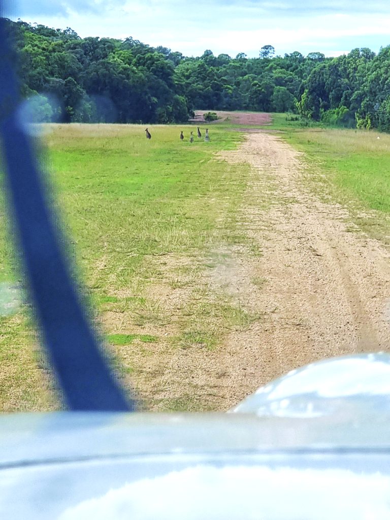
Back then to the runway at Agnes Water. The weather had some puffy cumulus forming up over land, but just offshore looked good. A check of the weather online again for the umpteenth time and we were ready. At least, after scaring the roos off the strip, I was ready.
Dammit Skippy, I’ve got places to be! I didn’t have far to go because we needed to fuel up in Gladstone. YGLA has a kinda weird multi-level apron. I, of course, picked the wrong area and had to go back out to the taxi-way to move to the GA area where the AvGas bowser was. Fuelling up, we filled the auxiliary tank as well for the first time this trip. Departing on 28 out of Gladstone, there’s right hand circuit. That lines you up perfectly for the THREE 500 FOOT HIGH CHIMNEYS visible from the runway. As it turned out, it wasn’t a problem, but it makes you wonder what the hell was on the left side that they thought a right-hand circuit towards those chimneys was a good idea. Anyhoo, chimneys avoided I proceeded out over water to the north east, leaving Gladstone – where there’s a cool waterfront park and a great fish market if you happen to visit.
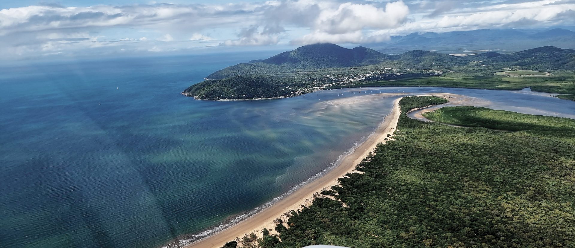
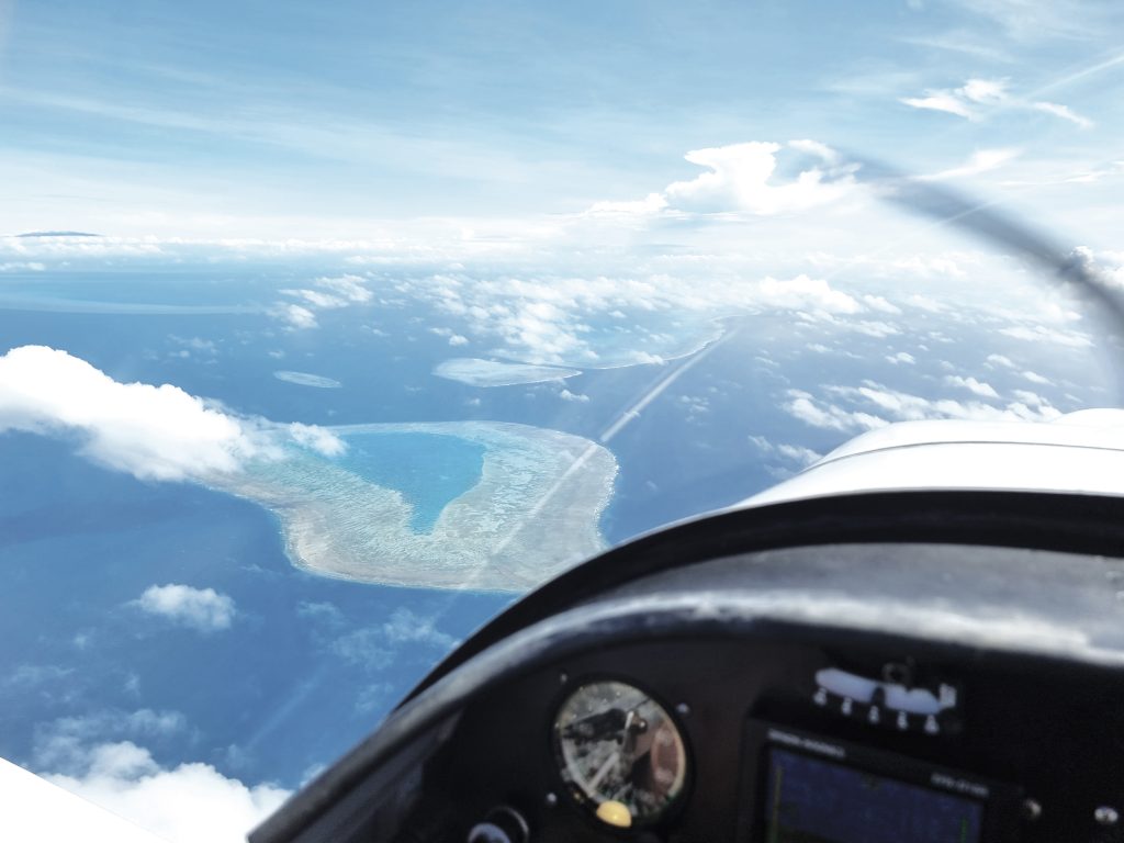
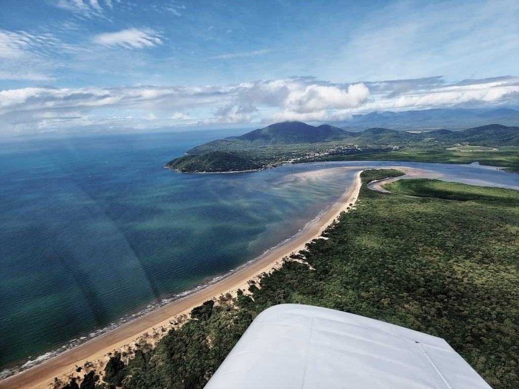
With a strong desire to avoid the controlled airspace extending from Rockhampton to Cairns and an eye on the weather, I had prepared both an inland and coastal flight plan for Cooktown, my next stop. Have a look at the map; that area is a sea of controlled airspace. Because the weather was tending towards puffy cumulus (that’s my technical term) which clumped together (more technical terms) during the day over land and a few scattered puffballs (you’re getting the idea) over the water, I went feet wet. I’m so glad I did, because on top of smooth, cloud free flying I got great views as I flew between — and occasionally over — the Great Barrier Reef and the coast. In all my flying days I would be hard pressed to think of a better flight. It was four and a half hours long and I enjoyed it all.
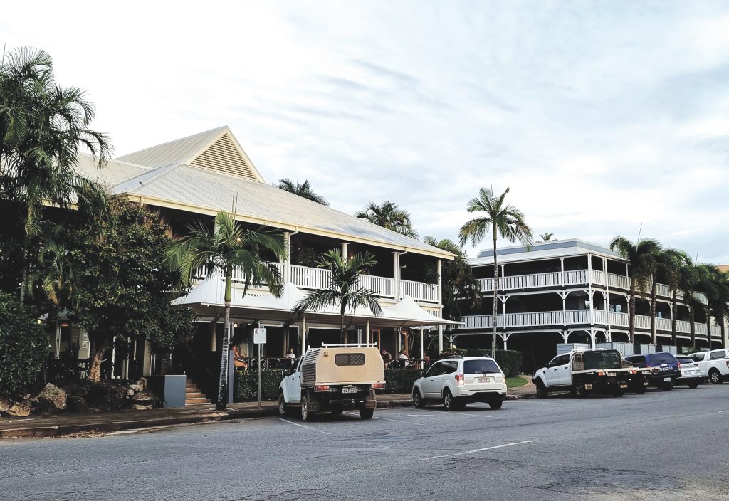
You might think four and a half hours is a long time in a small plane, but I never got bored. Out the window was a stupendous view. If I got tired of that I could continue learning the intricacies of my Garmin KLX135A. Yes, I could operate the radio well enough, but despite being an older unit, it had the capacity to navigate via GPS and other features I thought I should be able to operate. Particularly the one that would find the nearest airfield and give me a quick bearing. I also had my music or podcasts via the bluetooth on the Bose A20 headset (thank you for noise cancelling) and there was always the check-off of nav spots and frequency changes. There’s quite a lot when you go past Rockhampton, Mackay, Townsville and Cairns in one flight. By mid-afternoon I was approaching Cooktown. There was a band of cloud – remember those puffy cumulus that were bunching up? – above about 2700ft. To make things interesting, my line of flight would take me over Mt Cook. Really just a hill with aspirations, its peak is about 1400 feet with a ridge either side. Plenty of room, but still pause for thought. As I was completing my descent we were moving along at about 160kts, so as I cleared the ridge the airfield was suddenly right there in front of me. Typically, after hearing nothing on the radio for ages, Cooktown was obviously the place to be with 3 aircraft inbound and one departing. Why do airfields get busier when I approach? Is someone organising this? It’s here I raise a small bone of contention with the people on long final on a straight in approach who call in about, I don’t know, a gazillion miles out for On Final. Seriously, are you still climbing out from wherever you departed when you make that call? Anyhoo, we sorted ourselves out and I dropped in to Cooktown’s charming airport. It’s a lovely spot, albeit about 28 degrees and a bit sweaty for us frost-bitten southerners. So green. So tropical. Got a lift in to town and spent the night at the Sovereign Resort Hotel in the main street. Not cheap, but a great spot with a bar and restaurant. Emphasis on Bar. Cooktown is just a lovely coastal village and full of history. I managed an evening walk up the main street and that was about it. I marked it down as needing a lengthier stay sometime soon. Back in the room I looked at the weather for the millionth time, rechecked tomorrow’s flight plan, submitted my flight plan and SARTIME and called it a day.
Next morning I fuelled up again. That was to be a recurring theme. Who goes on a long trip when fuel is at record prices? Me, apparently. And why is fuel cheaper in Cooktown than it is in Gladstone? It’s a conspiracy, I tell you. As I departed toward the coast I had views back across the Endeavour River to Cooktown, Mt Cook and everything else named Cook or a derivative. I had two thoughts – firstly, that I really needed to get back here sometime soon and secondly that the people in the place-naming department need a good, swift kick for lack of imagination. Today’s trip would be Cooktown to Boigu Island, if all went well.
After the previous day’s busy airspace and radio chatter, today would be very quiet. There’s not controlled airspace past Cairns and the coastal settlements are small and spread out. So too are the airports, something that weighs on the mind of a single-engine aircraft pilot flying over water. The trusty Lycoming 320 never missed a beat and we just cruised on through another day’s gorgeous flying. You gotta love state of the art 1950’s engine technology. Leaving Lizard Island to my right I tracked coastal past Lockhart River and, well, I just kept going. Another glorious day of Barrier Reef flying, past Northern Peninsula, Horn Island, Thursday Island, probably Gilligan’s Island… and on to Boigu. My track took me over the western edge of the York Peninsula – the topmost bit of the Australian mainland. Even from 4500 feet I could see clear across York Peninsula to the other side at the point it runs about 10nm wide. I’d never been here before and it is one of those mythical places for Australians. We look at it on the map for years and here I was, finally seeing it. Horn Island is just to the northwest and I could see it, but my track was right of it, continuing just west of north for Boigu. I had decided to run a little west of the shortest route because that would run me near the chain of islands that extend from Cape York to New Guinea, most of which had a landing strip. It’s always nice to have options. So, Moa, Badu and Mabuiag Island slid under the wing in short order. Each looking like paradise from that height. Finally, after only 3 hours flying, I could see a smudge on the horizon. No, it wasn’t the remains of some bug from Cooktown on the windshield, it was New Guinea, with (hopefully) the mythical island of Boigu nestled in close to it. Getting closer, I could see the small strait between the island and the New Guinea mainland. This was it!

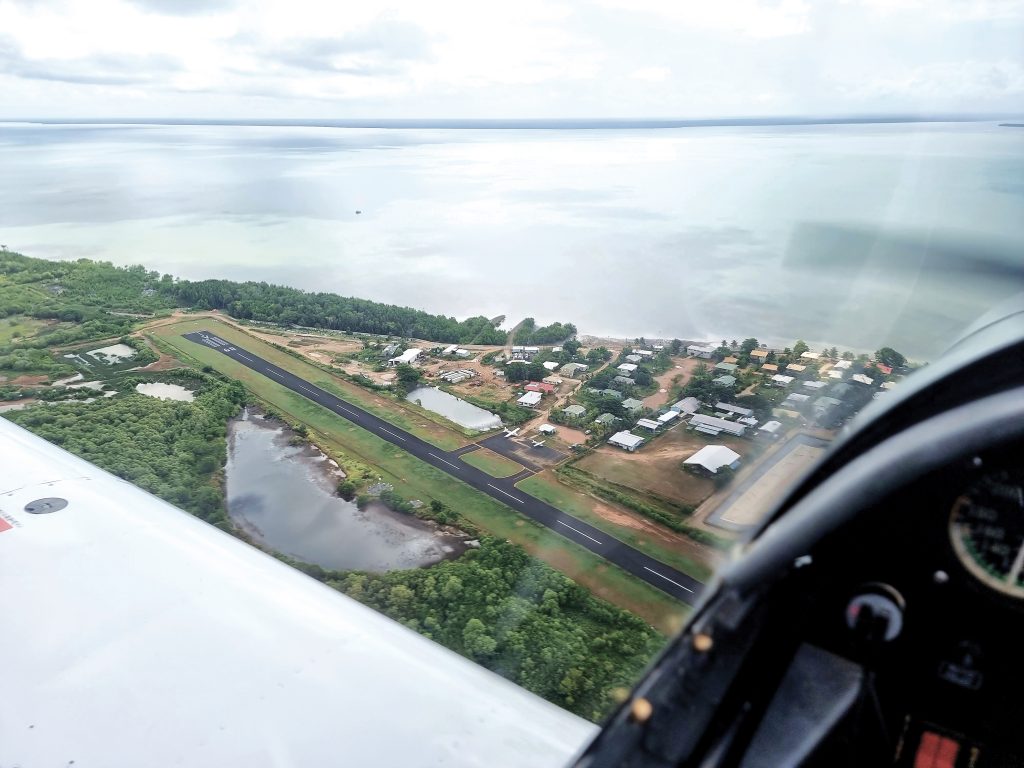
I suddenly realised I had never landed on an island before. Would that matter? Only one way to find out… I approached exactly as I would any other airport – made my call 10 nm out, started descent to arrive 500ft above circuit height to arrive over top and have my first good look at the strip and windsock. With an elevation of 10ft, the maths was easy. About a mile out I was over the edge of Boigu, which turned out to be almost entirely mangrove swamp with a couple of football fields worth of habitable land at one edge, along with an airstrip. Over top it looked like a reasonable sealed airstrip, with a 10knot-ish easterly blowing. I called my intention for 09 and found myself on downwind overwater with Boigu on my left and New Guinea on my right. The familiar drill, BOMFH (Brakes, Oil pressures and temps, Mixture, Fuel on and sufficient, Hatches and harnesses secure), turn base and call, half flap, turn final, full flap and I was dropping over the piano keys and flaring.
I had read on a website somewhere that Boigu Airport had a potential bird and crocodile hazard. The words crocodile and hazard kind of took over in my brain at that point as I imagine crocs lined up on the apron or launching from the tall grass to grab me as I tied the plane down. The bit I should have been paying attention to was the bird hazard. Just at that point where I pulled back all the power, birds sprang up from everywhere. Literally a mob right in front of the prop. I instinctively pulled back on the stick to go over them. Not cool when you have just killed the power. Clear of the birds in seconds, a quick glance at the ASI told me either nose down or power. I pushed the nose over, with plenty of runway left, and flared for a normal landing. That was more exciting than I needed. I taxied to the small holding bay, popping the canopy for ventilation.
I’d done it. I’d made it to the northernmost airport in Oz. I could have just sat there and basked in the glory for a while, but the temperature on the ground was about 32 and the cockpit was rapidly taking on the consistency of an armpit. I clambered out and started to sort out baggage, tie-downs and the detritus of an extended snacking regime, while keeping a wary eye for crocodiles. Seems Boigu is set up more for day visitors than overnighters. An islander and a Cessna 206 – mainstays of island traffic – were parked. At the gate I was met by the welcoming party of a small child and a mongrel dog who were wandering by. I had arrived.
The first job was to find the town council offices. How hard could it be on an island this small, with one main street? Too hard apparently, as I missed the offices and found myself – hot and sweaty – at the other end of the settlement. I spotted a church with a shelter and picnic table outside at the waters edge. It had people sitting under it. Maybe they knew where the hell this building was? It turned out to include a rather nice lady from Border Force who was sitting looking out over the water towards New Guinea. Nice work if you can get it.
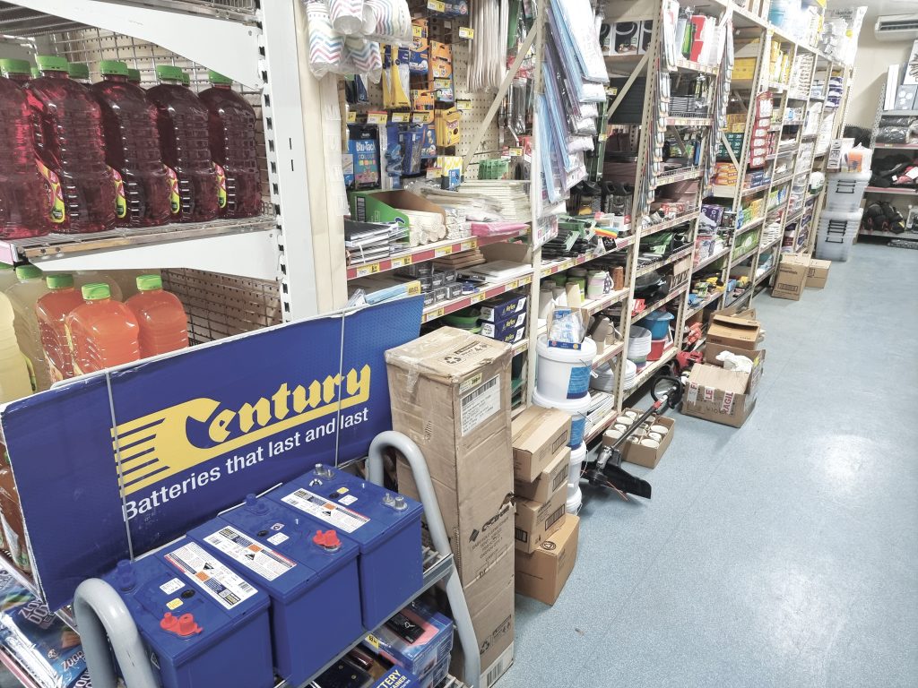
Turns out, after 2000 miles of effective navigation I had finally gotten lost in the last 500 metres. Properly directed, I found the council offices and was issued with a key to the Boigu Motel. I say motel, but really, it’s a local house converted to purpose. It was pretty nice and had a hot shower, which was all I wanted right then. What it didn’t have was food. The only source of food on the island is the supermarket. Actually, the source for everything on the island is the supermarket. Whipper snipper? Check. Car Batteries? Check. Lottery Ticket? Check.
Duly loaded up with snacks/drinks/pot noodles and comestibles for the next day’s flying, I settled in for my now regular evening of flight planning. The motel room was well equipped, including what looked like an oversized pooper-scooper set that was a bit puzzling. At 3am when I got up to pee and turned on the light to see cockroach the size of a poodle sitting looking at me, that set came in to its own, as I clubbed the beast to death and scooped him up. It was a near-run thing. Forget the crocodiles, it’s the bugs that will kill you here.
Next day, refreshed despite the bug episode, I traipsed back across town to drop off the key and grab some last-minute supplies from the ‘market. I had a quick chat to Matt, one of the visiting pilots from Horn Island. They flew multiple services to each island most days. I guess it’s the smart way to get around up here. No fuel at Boigu though. Lucky, I had brought plenty with me from Cooktown. I only had to go 30 minutes today, down to Horn Island. A fuel check revealed over 70 litres still on board. More than enough. It was early but already starting to warm up. So, a rapid pre-flight and taxi. Sitting at the end of 09, the mangroves at the other end looked a lot closer than they had on landing. Hmmm. As it turned out, we were up and going halfway down the strip. 110 litres less onboard makes a difference. A last run down between New Guinea and Boigu (What do they do if I infringe New Guinea airspace I wondered?) and set course a little east of south for Horn Island, almost tracking back over yesterday’s journey. With just 30nm to Horn, I stayed low and I’m glad I did. If you get the chance to zoom over tropical coral reefs and sand cays at 1500 feet, take it. All too soon I was coming up on Horn Island. This is a big old WWII airstrip that is the aviation hub of the Torres Strait islands. During the war they clearly needed an airbase to support the military outpost at Thursday Island. Unfortunately, Thursday Island is tiny, so they had to put it on nearby Horn Island, meaning it’s a 10-minute ferry between the two. YHID has some interesting local rules. You can’t take off on runway 14, nor land on 32 due to terrain. Terrain? There isn’t so much as a hill nearby, but them’s the rules. Maybe it has something to do with the blasting notice that’s also in the ERSA. Luckily, we were just landing, so no issue.
As I taxied to the apron and terminal a nice voice (why do ground people never identify themselves) came over the radio and suggested I park just off 32 near the windsock on the grass. Cool. Consider me parked. The stakes weren’t going in to this mix of sand, gravel and I suspect buried concrete, so the wheel chocks and a few handy rocks would have to suffice to stop the aircraft blowing away overnight. Fingers crossed, I strolled to the terminal which was the only GA gate and tried to organise transport to Thursday Island. There was over a dozen commercial aircraft – Islanders, Caravans, 206s and Pipers mostly filling the main apron – hence the ground ops request for me to park outside.


A bus, a charming ferry ride and another short bus ride later I was on Thursday Island at the Thursday Island Motel. How long was the meeting where they came up with the name for that? ‘Bout 3 minutes, I reckon. Nice Motel. I decided to take a walk and try to find the WWII era hill fort nearby. Big mistake. Hot, sweaty, chafing. After half an hour I abandoned that mission and went to look for a pub. Much smarter. The Grand Hotel wasn’t particularly grand, but had a nice view over the water. A couple of drinks and some dinner later I was feeling remarkably civilised. So civilised I was wondering about making it back to the motel, but a pleasant and slightly wobbly waterfront stroll got me back there. The temperature had dropped to a very therapeutic twenty something. This was more like it. I had now become so accustomed to the overnight warmth that I didn’t even have a fan on that night. Thoroughly exhausted from my adventures, or possibly the drink and dinner, I slept like a log.

No time to delay next morning. The ferry was leaving at 9am and they seemed very particular about you being on the ferry you had booked. Once at the airport terminal, which was already busy, I was pleased to see the hole-in-the-wall snack bar was operational, because this was my entire catering plan for the day. I loaded up on sandwiches, hoping I wouldn’t regret the egg and lettuce, then rang the nice local ARO (those acronyms again. Grrr) for the entry code for the gate and got to the plane. Fortunately, it was still where I left it. Today’s plan was Horn Island to Longreach with a fuel stop at Georgetown. There’s no self-serve fuel on Horn Island, so I had arranged to meet the fuel tanker at 10am at the plane. It’s a little tricky trying to get the great big nozzle designed for commercial aircraft into the little auxiliary tank, but we managed without flooding the cockpit with fuel. With 184 litres on board and checks complete, I headed out of Horn. A quick flyover of Thursday Island and we set course almost due south. Minutes later we were back over continental Australia and tracking straight down for Georgetown, which sits in the centre of the York Peninsula. With a layer of scattered cumulus at 2-4k, I headed on up to loftier and cooler climes. 6500 worked well and I set up for a 150kts cruise. I’d rung ahead the night before to the Georgetown Roadhouse. They would be there with fuel at the airport. Either ring as you overfly or buzz the town and they’d come out. You gotta love regional Oz. The flight was over a whole lot of very green country with occasional flooded bits. The rainy season just wasn’t giving up this year. There wasn’t much to mark off on the flight route for visual reference. Fortunately, Georgetown popped up on the horizon after 4 hours. Whoever designed the strip for Georgetown decided that you would turn final right over the township and roadhouse – which saved a phone call – and I really hope those people under late final appreciated my smooth and consistent approach. Better still, Jason from the Roadhouse was already there with the ute and a couple of drums of Avgas. The temperature had dropped since Horn Island, but the sun had some bite. We brimmed all tanks and after a quick visit to the little pilots’ room, headed south again for Longreach.
Longreach is a spiritual home of aviation in Australia. Birthplace of Qantas, it features the Founders Museum. Given that they had flown a 747 in there, I thought I’d be able to make it in safely. The country slowly changed from the green of Capricornia to the redder tinges of inner Australia. A mere 2 hours later – I’m getting used to those long legs – we were descending. Someone had left their descent a little late. It might have been me. So I was fairly rocketing along still as I joined overhead. Woah, Nelly! I think the little plane was as keen as I was to get on the ground. With the aircraft slowed down and turning final I was faced with almost 2 kilometres of 35-metre-wide runway. They told me that when they landed the 747 there the outer engines hung out over the runway edges. I shouldn’t have that problem.
I had decided to spend a full day in Longreach to give me time at the Museum. A day off from flying would be good too. I don’t know what the aviation equivalent to saddle sore is, but I had it. Cockpit chafed? Cabin fevered? Doesn’t really work, does it?