As a team with recreational, private, military and commercial pilot experience, OzRunways understands the importance of closing the hangar doors at the end of the day and going home after a safe and enjoyable flight. As proactive educators, the OzRunways team are on a mission to show pilots about the app features designed to improve safety. Here, they’ve outlined the top 10 features you should be across before your next adventure.
1. Weather Overlay
Visualising weather while interpreting briefings is a critical and timely aspect of flight planning. OzRunways makes it easier to understand the weather along your route with near real-time conditions as a map overlay. See departure, en-route and destination conditions like precipitation, cloud cover and recent lightning strikes. This increased situational awareness can assist with weather avoidance and diversions in an ever-changing environment.

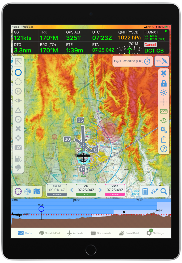
2. Two-Finger Map Ruler
A favourite safety feature for many pilots is easily one of the simplest! By pressing and holding two fingers on the map screen, a ruler will appear. Say goodbye to the headache of manual measurements and that darned whiz wheel. Easily move to adjust the ruler position and customise the unit options for things like distance and bearing type.
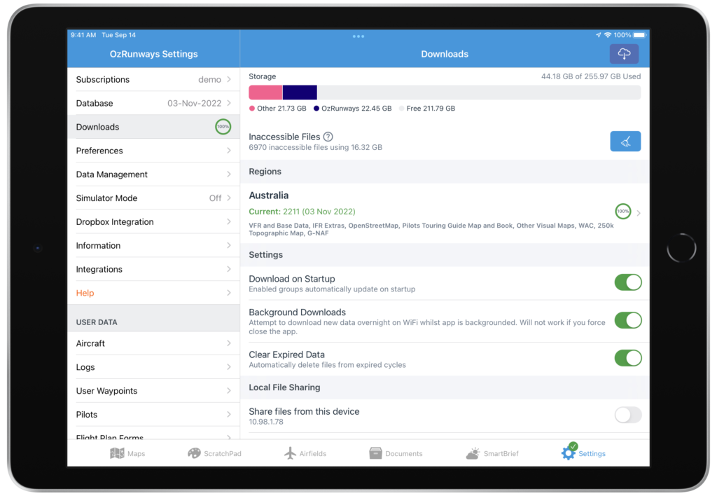
3. Automatic Downloads
Physically updating new document amendments is a boring, timely and problematic task if done manually – and did we mention it’s boring? Turning on automatic downloads within the EFB apps is the safest way you can ensure you always operate with the latest documents.
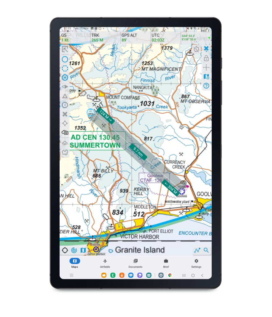
4. Smart Terrain Overlay
Staying safely clear of terrain, but below controlled airspace and cloud bases, can be challenging in the vicinity of busy, built-up areas. Using high resolution NASA terrain data and the latest Airservices obstacle database, Smart Terrain provides an interactive terrain overlay for planning and in-flight use. Use it along with Terrain Ahead View to visualise the high risk areas of your flight so you can safely maintain terrain clearance and stay out of trouble.
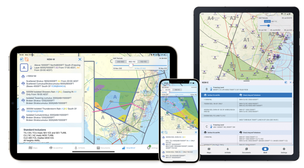
5. Smart Brief
OzRunways sorts through every weather briefing available, so you don’t have to! SmartBrief allows you to view the weather and NOTAMs relevant to each leg of your flight in a Smart and interactive format. SmartBrief fetches new data on app launch and every 5 minutes thereafter. Understanding the frustration of limited internet for pilots in remote areas, SmartBrief caches the last fetched data Australia-wide to make it available offline when you’re outside of internet coverage.
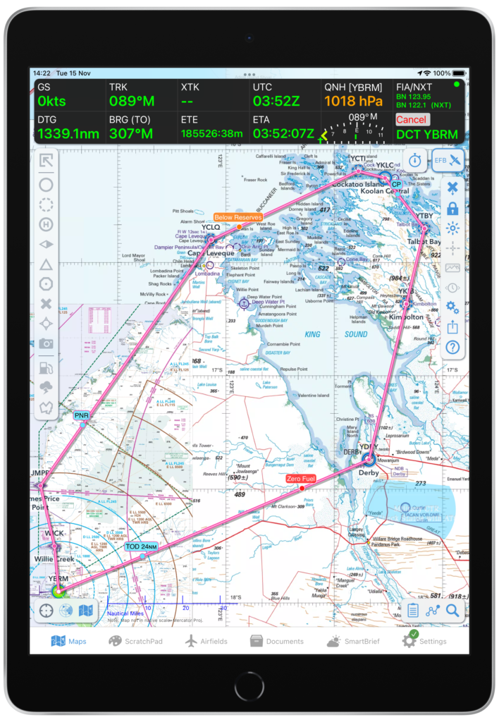
6. Sector Features
You can better-understand how wind and fuel impact your in-flight decision-making around whether to continue or turn back. OzRunways uses calculations at an ATPL level to ensure the app provides the most accurate Critical Point (CP) and Point of No Return (PNR) indicators for every route. They’ve taken safety one step further, by adding Zero Fuel and Fuel Critical indicators, along with a toggle on/off function should you choose to hide this feature.
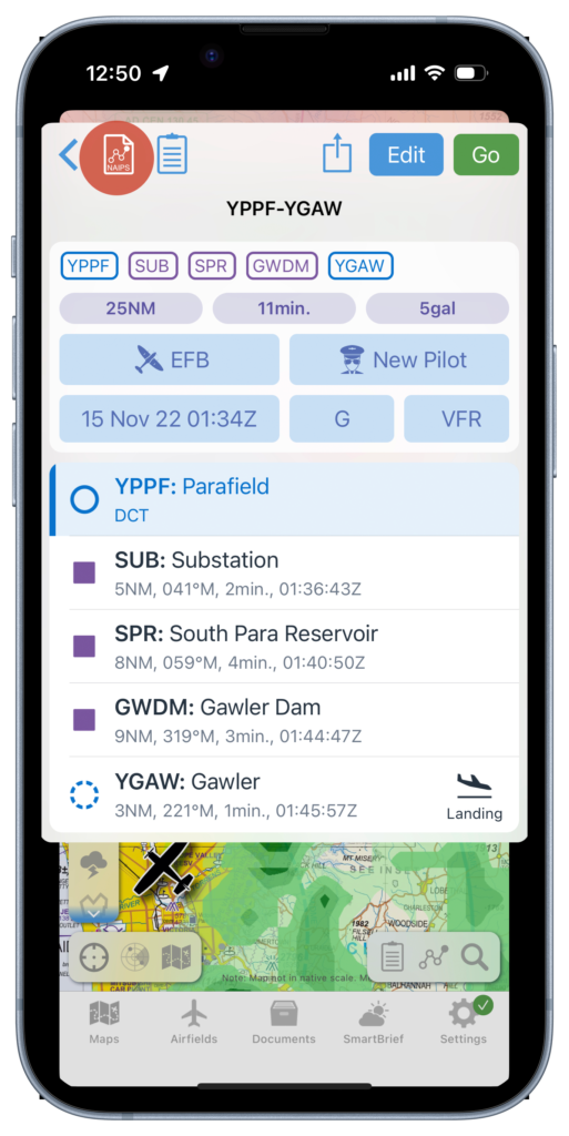
7. NAIPS Integration
Avoid any double-handling by jumping between apps or browsers and submit your flight plan directly into NAIPS with a registered SAR time for your flight. You can expect the same field layout and requirements as the ICAO Flight Notification through Airservices.
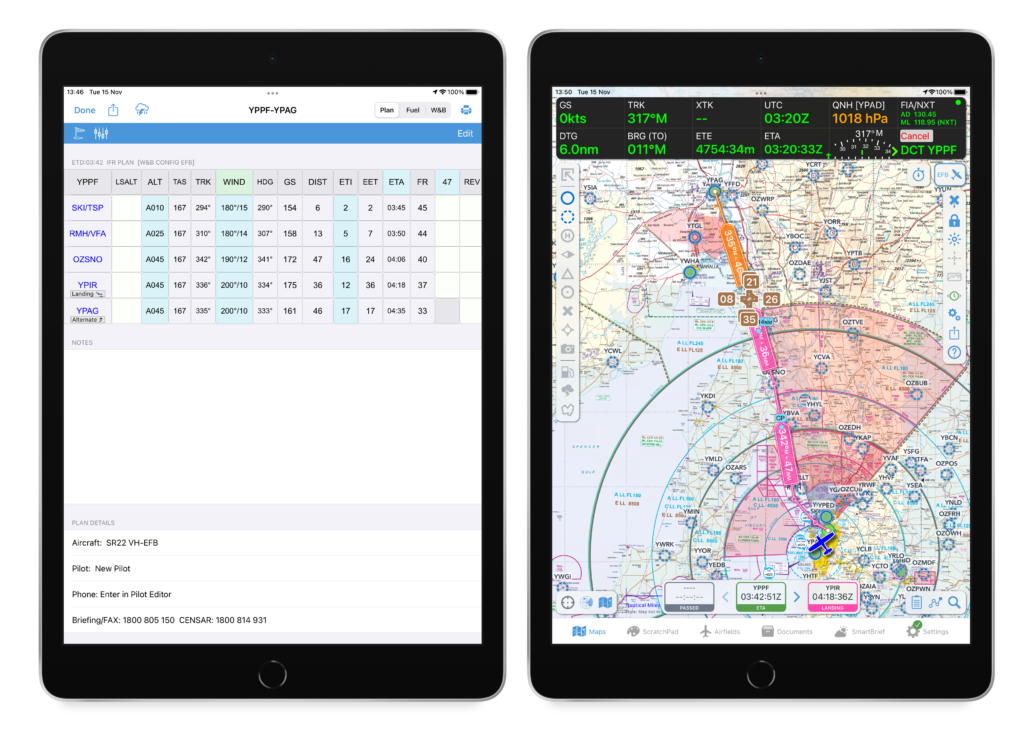
8. Setting Up an Alternate
With just a single tap on the plan sheet, you can nominate an alternate airfield and have every plan B calculation ready to go. Reduce your mental workload and in-flight recalculations when things get hairy, and fly onward to a suitable and safer destination.
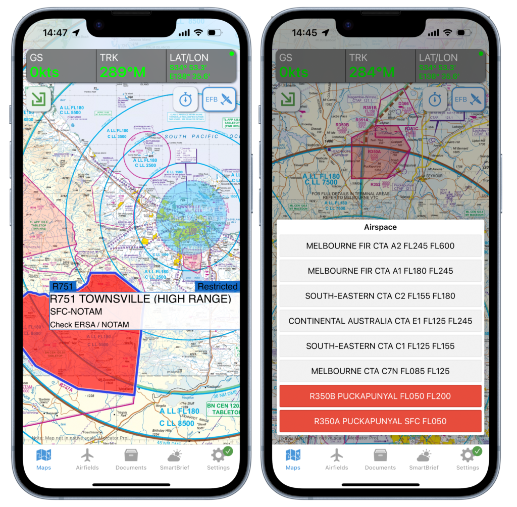
9. Restricted Airspace and Military CTR Highlighting
Inadvertently flying through restricted airspace can be an embarrassing, but more importantly, an unsafe event. OzRunways uses the NAIPS RA briefing to highlight areas that may be currently active and prompt pilots to further investigate NOTAMs. A red map overlay flags restricted areas that may be active, while a blue overlay flags military CTR. This colour system is effective at prompting potentially unsafe flying areas, however, pilots should never assume airspace availability without confirming themselves via NAIPS and/or ATC.