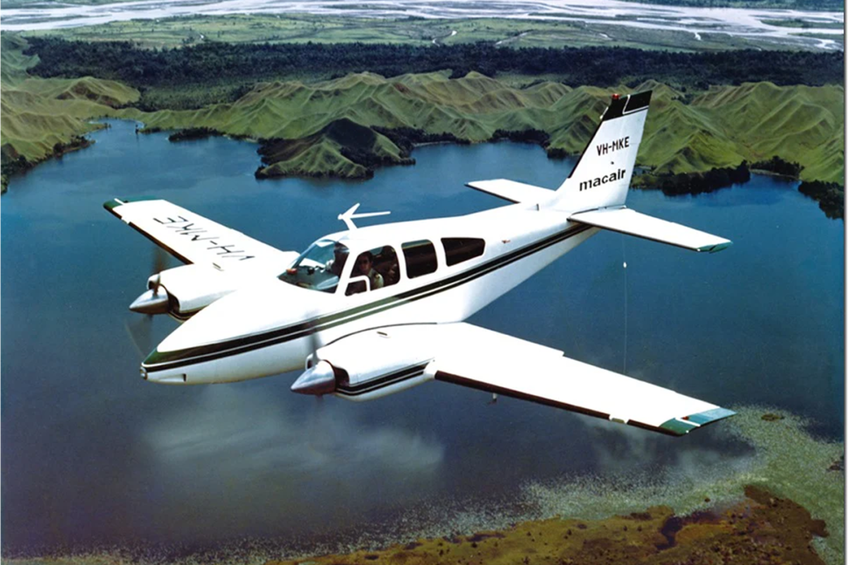
NICHOLAS HEATH TRAVERSES THE TOP GULF TO THE KIMBERLEY AND MEETS SOME… INTERESTING PEOPLE ALONG THE WAY.
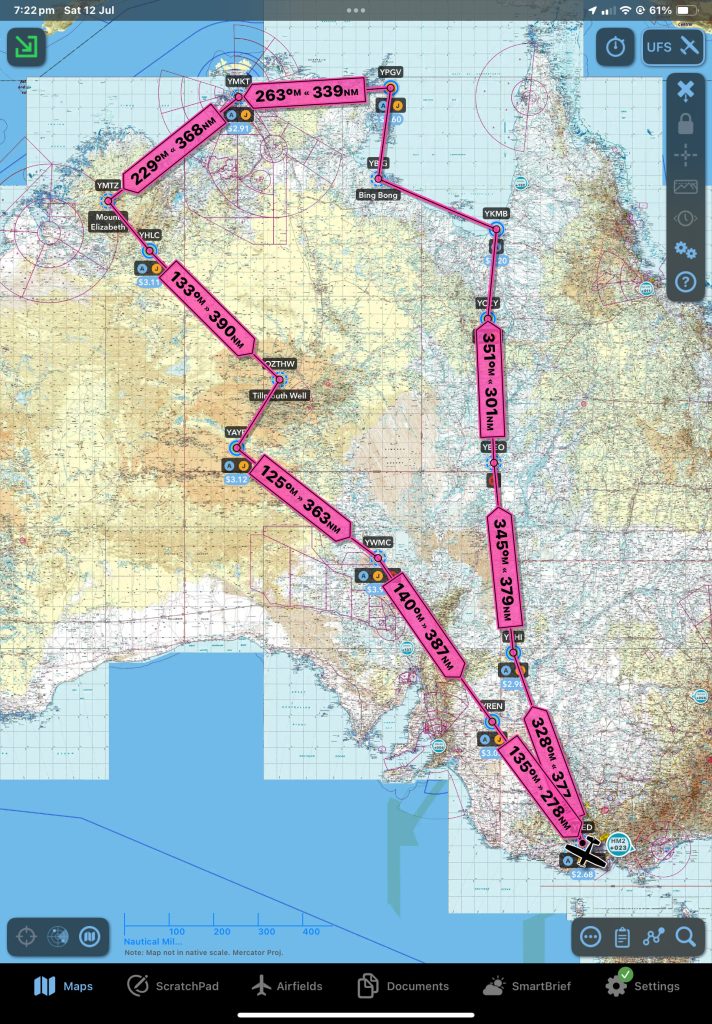
You know it’s going to be an interesting day when you ring the proprietor of an airstrip and ask what the conditions are like, and they say “we’ve just had 70 mm of rain. It’s going to be a bit soft…”. But that was some days away, and let’s start this story where it begins – back in Geelong, planning. In all my flying adventures, the one chunk of Aus that I had largely missed was the Gulf to the Kimberley. This trip was to cover that zone, but first I had to get there. I had some rules. No staying anywhere I had stayed before and no staying at anything with the word resort in its name. Hotel, motel, roadhouse, camping would be just fine… The route would then follow the Gulf around Arnhem Land. So, for your armchair travelling pleasure, here we go…
PREPARATIONS
Fighting the temptation to pack every item I own when doing long distance flying is a battle that’s real. Once I’d amassed everything I thought I needed, it looked like enough to fill a medium SUV. Some winnowing was in order. About half the food and clothing went first. The camping gear could stay. Each item was given the Marie Kondo treatment (Will this make my heart warm?) before joining the discard pile. I didn’t get to snapping the long bit off the toothbrush stage, but it was close.
BETOOTA BOUND
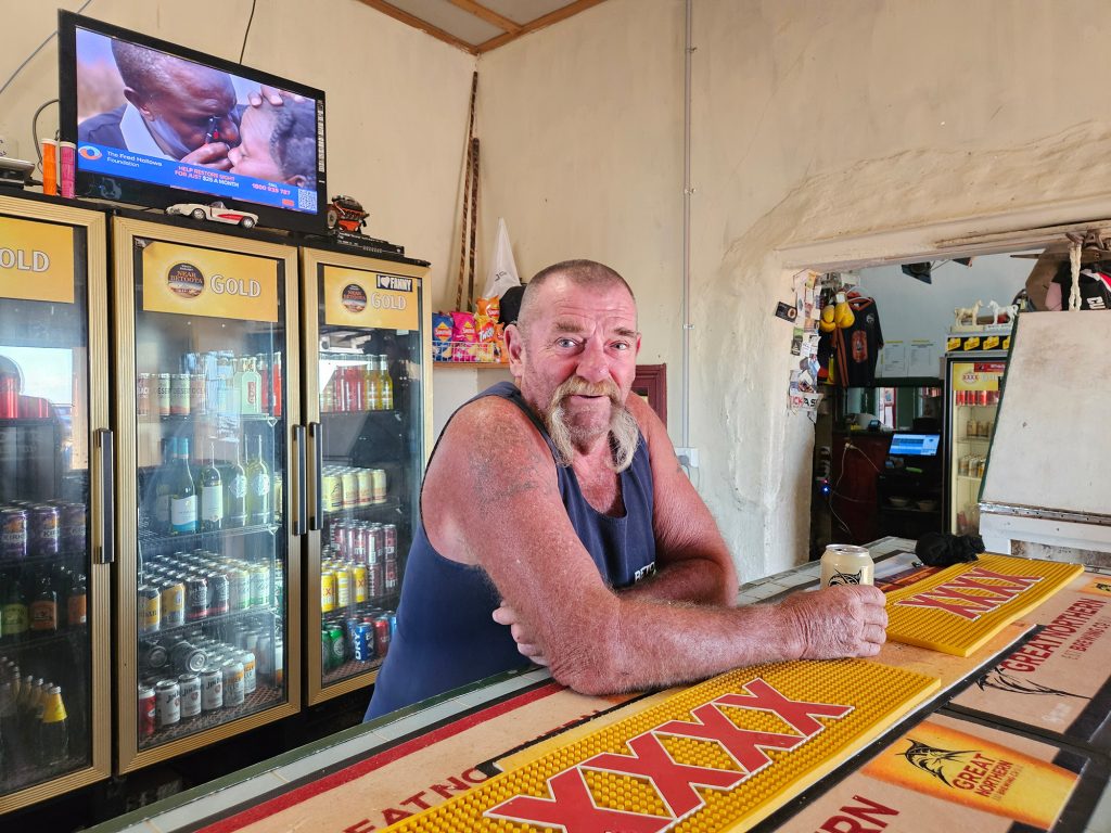
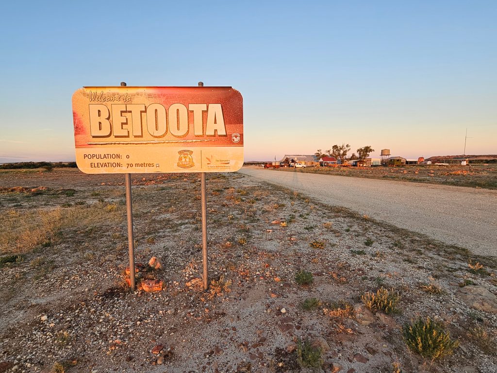
The plan was to go straight up the SA/NSW then SA/QLD border and camp at the Dig Tree. For those educated after 1990 – when explorers got yeeted out of the curriculum – the Dig Tree is a place on the Cooper Creek that Burke and Wills used as a base when exploring their way to the Gulf. It’s a thing. But not anymore apparently, as I discovered when I explained my route choices to some of the younger staff members who thought Burke and Wills might be a gentleman’s clothing brand or similar. Look it up. Anyhoo… I had this idea to follow roughly the trail of Burke and Wills to the Gulf for the first leg. But the weather gods wouldn’t have it. The 1-in-500-year flood event had meant that the Dig Tree and associated airstrip were underwater. Bother. Where could I go instead? I’m not sure how many of you follow an online spoof publication called the Betoota Advocate — but you should, because it’s funny. It pretends to be the daily news from Betoota, commenting on social memes from around the world from its fictional base in a largely imagined Betoota. Thing is, Betoota is a real place and the publicity from social media garnered enough interest that the Pub there – the only building in Betoota – reopened. It’s about 200 clicks east of Birdsville. I rang. They had beer, food and a bed. My favourite things! What they didn’t have was AVGAS. So, a quick stop enroute at my old stomping ground of Broken Hill for fuel would be required.
Having packed every nook and crevice of the RV, I departed YLED Lethbridge in mostly clear skies. A very unremarkable two hours later saw me just west of Menindee. At this point the new ADS-B in and out we had fitted last year using the government subsidy came into its own. A Cessna twin flying IFR was behind me and above, on a route to Broken Hill and gradually overtaking me. I could see him. He could see me. As he was on IFR he would be doing a templated IFR approach straight in and I would be on the traditional joining circuit approach. We chatted and sorted it out. If we timed it right, I would be on downwind as he was on short final for 23. Arriving at the field, the wind sock indicated a bit of crosswind, but everyone was using 23 so I joined in. This was mistake number one. The Cessna twin duly appeared on short final, and I followed him in. On short final it became apparent that the crosswind was a bit fiercer than expected and being Broken Hill in the afternoon, it was turbulent. But the previous aircraft seemed to be ok… so I would proceed on 23. That was mistake number two. I wrestled the thing to the threshold and then did that tap dance you do to keep the aircraft on line and wings level at a the right speed… it gets hectic… at the flare it all looked good… and then we fell out of the sky. Just dropped like a large heavy thing. And bounced. A lot. I’m pretty sure that should be three landings in the log book. The only positive aspect was that I maintained a pretty good line and avoided slamming the nose gear down. The Cessna twin was at the bowser, and I said something along the lines of his being an uncomfortable landing and I thought maybe he could have let me know. But all the signs were there for me to ignore. What I should have done is politely called a go-around and reset for the dirt cross strip.
So, it was a somewhat chagrined pilot who departed on the dirt cross strip a little while later, Betoota bound. Munching on my Chicken and Cheeseslaw sandwich a bit later (a Broken Hill specialty), I reached the Cooper and the flood country. All the way up the country had been burnt and dry – courtesy of the nastiest little drought we had seen in a long time. Approaching the Cooper things started to turn green. In lieu of a landing I circled the Dig Tree, took some pics and headed north. Far from being red and dry, the interior was verdant with every sand dune valley filled with greenery. A fairly rare site. Arriving over Betoota I had a very long and calculating look at the windsock, but by now the wind had dropped to almost nothing. I greased it on in a landing that would set the tone for the rest of the trip. I have to say that the Betoota landing strip is in excellent order. Wide, rolled and well drained.
AN END TO PEGGING
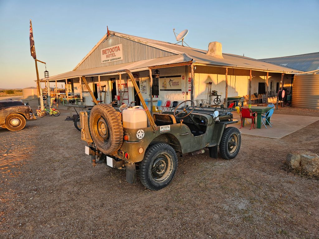
I have parked in places where you could get gale force winds overnight, so I don’t mess around when tying the aircraft down. I had finally made the transition from carrying several cut down star pickets and a mallet to wham them in with, to screw pegs which can be driven with a small rechargeable impact wrench. But, guess who left the specially-purchased impact wrench sitting in the back seat of his car. Fortunately, a jeep arrived. Literally. The WWII kind. With Robbo the publican onboard offering a lift. Robbo had an impact wrench and was back a moment later to facilitate tie down.
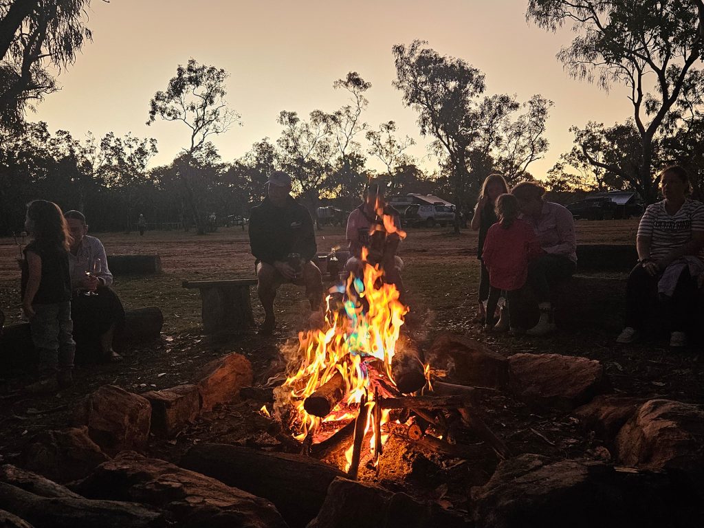
The Betoota Hotel is hard to describe. The pictures really don’t do it justice. It’s a sprawling shed meets station house. Structures have been added to the additions. But it works. My bed for the night was a shearers bunk on the screened verandah. Dinner was when it happened. Drinks were always happening. The crowd that night were some campers, Robbo’s collection of staff/friends and caravanners. Stories were told around the campfire. Some were even true.
ANYONE FOR GULF?
After a surprisingly restful night’s sleep – courtesy of foamy earplugs to block the generator drone – and a breakfast to make a heart specialist weep – the journey resumed.
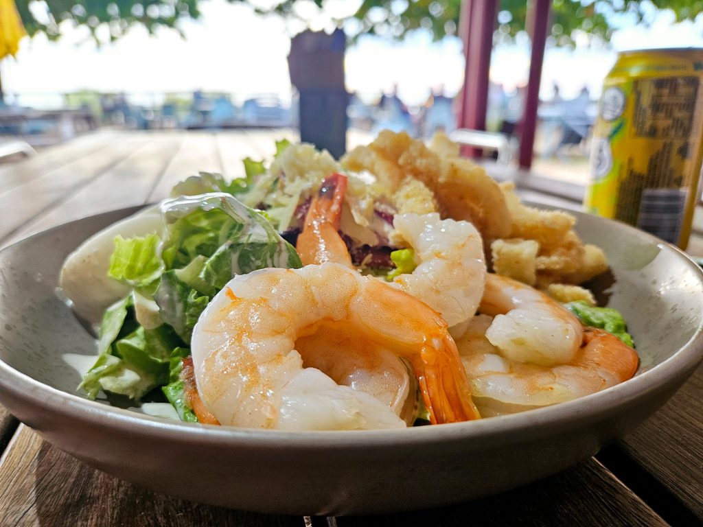
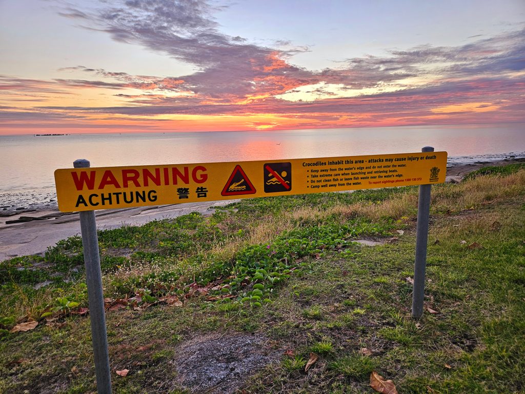
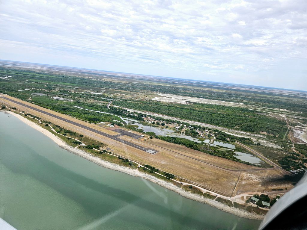
Our target for today was Karumba. Turns out it’s not just an expression. It’s a town on the Gulf. It had everything I look for. Beach, all-weather runway. Fuel. Karumba is a port town, home of the prawn fleet. The airport is actually out of the main town at Karumba Point and that is where most visitors stay. When you see the sunset from the pub beer garden you will know why. The fishing is insane. I saw a guy sitting on the beach in front of us catch two blue nose (we would call it a blue-eyed trevalla) of about five kilos each in half an hour. I caught the Caesar with seafood at the pub. Big shout-out to the Savannah Shore who were kind enough to come and get me from the airport – even though it’s only about 800 metres. Still… it was a hot and sweaty day.
GOING BACK… BACK IN TO TIME
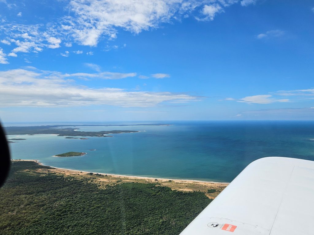
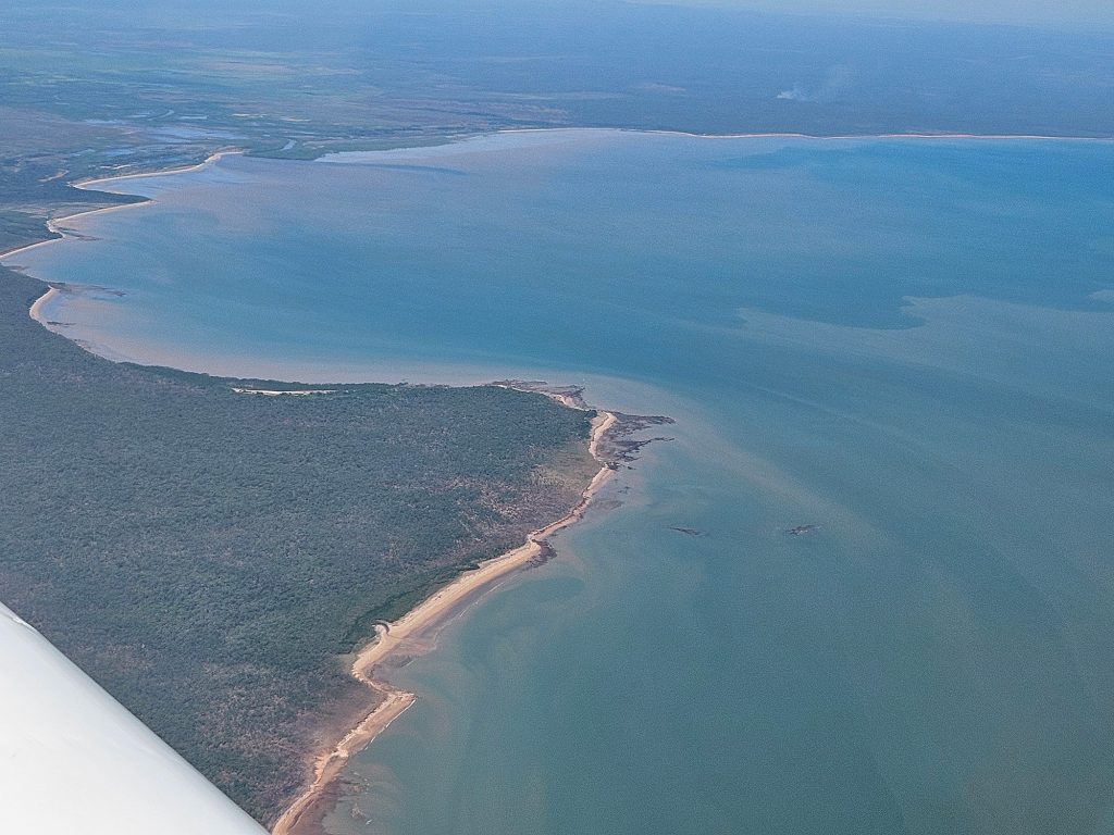
Departing Karumba with quite a few cumulus clouds lurking, I tracked the coastline. Passing over Burketown, I had closed the loop on the Burke and Wills theme. That was about as close as they got to the Gulf. Today’s flight would follow the curve of the Gulf track over Groote Eylandt, and arrive at Gove in Arnhem Land that afternoon. The only cloud on that horizon was… clouds on the horizon. Not the slightly famous “Morning Glory” which is a roll cloud that forms in the Gulf at the start of the wet season. These were layered cumulus. Which I guess makes them cumulo-stratus. Interspersed with the odd towering stack of “hell no”. I found a sweet spot about 6500 feet between a lower layer of scattered and top layer of broken cloud. Tracking coastal, the Gulf has a lot more islands than I knew about. The one I did know about – Groote Eylandt – was peeking out from the clouds which were definitely thickening. North of Groote Eylandt I found the front that was sweeping all these clouds toward me. A fairly solid bank of cloud rising to God knows how high and extending all the way to my left and right. Bother. High wasn’t going to get me over it. So, I tracked out from the coast a few miles. I was chasing what looked like a slightly higher base while still maintaining gliding distance to the beach. The advantage to being over water is that you aren’t going to hit a hill. Probably. If you know where you are. I found what I optimistically thought of as a gap that would let me keep clearances and discovered that the entire formation was only a few miles across. A very relieved me was able to climb back up to a sensible cruising height and continue in much clearer air.
Another motive for visiting this part of the world was that back in 2006-ish, I was part of a team that came up and built a school classroom at Garrthalala, about two and a half hours by car out of Nhulunbuy. We’re talking remote. The idea then – which has subsequently been proven to be valid – was that if local kids could stay and learn on their country they would do better than in larger towns. So local students from the region would arrive each week and do several days of schooling at Garrthalala – doubling the population briefly – and then would head back to their scattered communities and avoid the pitfalls of larger settlements. No sooner had we finished it, then the government defunded the project. Fortunately, saner thoughts prevailed and it is back up and running. It has even become a hub for university students coming into study.
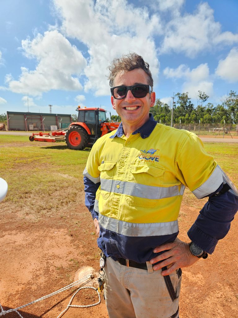
To visit Garrthalala you need a permit, which I didn’t have and takes quite a few months to acquire. So, I had to satisfy myself with a couple of low passes to see how the building was holding up. I was pleased to see that not only was it still there, but the new buildings for the university visit had been added. With that mission accomplished I set course for Nhulunbuy, which is the town, but actually I would be landing at Gove Airport. The benefits of air travel showed as the two and half hour car trip was covered by air in 15 minutes. The only complexity on arriving at Gove was the RAAF were up to their RAAF activities and were conducting missed approaches at Gove in C150 Hercules. Whenever I spot a C130 I think of the guy that told his girlfriend “That’s a C130. I fly a C150!”. All jokes aside I wasn’t going to argue, so a quick orbit to the south while the RAAF was RAAFing and then joined circuit for an uneventful landing. At the GA parking area I had the aircraft chocked, tied down and the cover on when the ARO arrived by tractor. As you do. “Great,” I thought. “he’s going to tell me to move”. It was hot and sweaty and all I wanted was to get to a room and have a shower. But all he had done was come to tell me the gate code. We chatted. Nice man. Should be more AROs like that. Ten minutes by taxi took me to the Walkabout Lodge in Gove which was nice enough but MY GOD THE PRICE. You have to remember that I am, at heart, a tightwad. So, close to $400 for a night made my eyes water. I guess it’s expensive running a place when everything has a two day road trip to get to you. Nhulunbuy is a funny town because it’s basically there for the mine – Rio Tinto mine the bauxite strip that runs across the Gulf and re-emerges at Weipa. They say the mine is closing, so I don’t know what happens to the town then, but it can’t be good. The Yolngu people populate the Gove Peninsula. I was lucky enough to spend some time living amongst them back in 2006 and was even inducted as an honorary member of the white cockatoo totem. That involves a lengthy nighttime corroboree and having white clay pasted across your forehead. Fortunately, it’s a one-time deal. I was able to restock the travelling snack pantry at the supermarket and lay my hands on an off-brand rechargeable drill to handle future tie down fun. Suitably armed and refreshed by the previous night’s float in the pool, I arrived at the lobby to find a whole bus load of a tour groups who were doing the area by private air charter. Their pilot had sent them all back to the motel and said “you ain’t going anywhere today”. I had spent some time already that day looking at the weather and had decided that the front coming through would probably ease by mid-morning and I could probably get out. The benefit of the mid-morning window was that I could indulge in my fifth favourite pastime – a long breakfast. Further reviews of the weather showed the rain band moving nicely and dissipating, so I figured I’d head to the airport and see how it looked – worst case scenario I could come back. I didn’t fancy the idea of shelling out for a second night. By the time I got to the airport the rain had stopped, and a few patches of blue were showing. It was a happy and less financially impaired pilot that took off from Gove and set course for Darwin, via Jabiru and the South Alligator River. I had steeled myself to either turn back or look for an alternate if the weather required it, but things only improved as we went along and I found myself back with scattered clouds below and a broken overcast above.
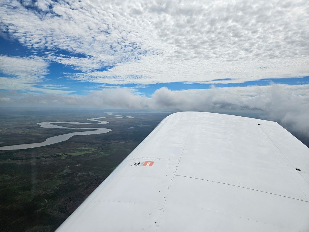
What a great day to be flying. Everything was fresh and green. So green – the late wet season was still not wanting to quit – which would cause problems for future me later – but the scenery was stunning. Just when I thought it couldn’t get better, I found the South Alligator River. It looked like the Congo. Suddenly I felt the need to check the fuel gauge, engine temps and instruments a lot. That didn’t look like a good place to land and, you know, alligators… Flying over Jabiru I was again amazed at how you can have a world class eco destination right next door to a uranium mine.
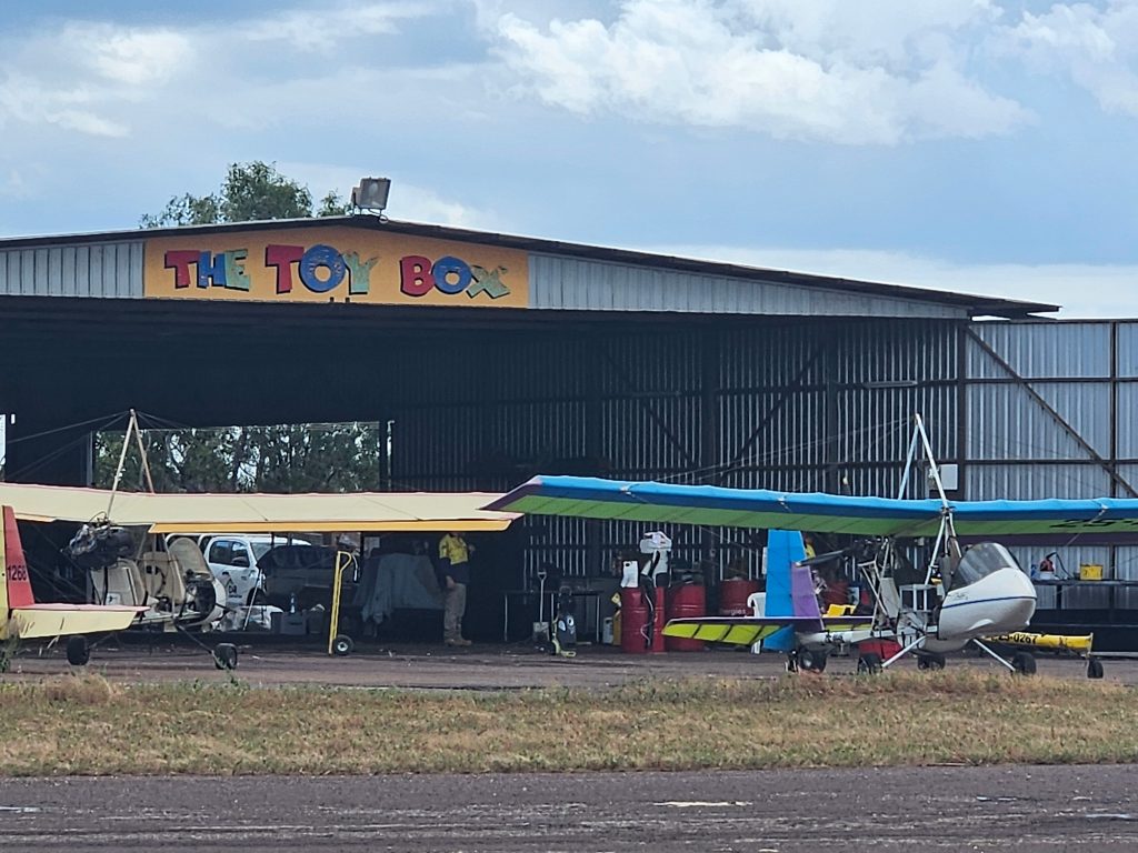
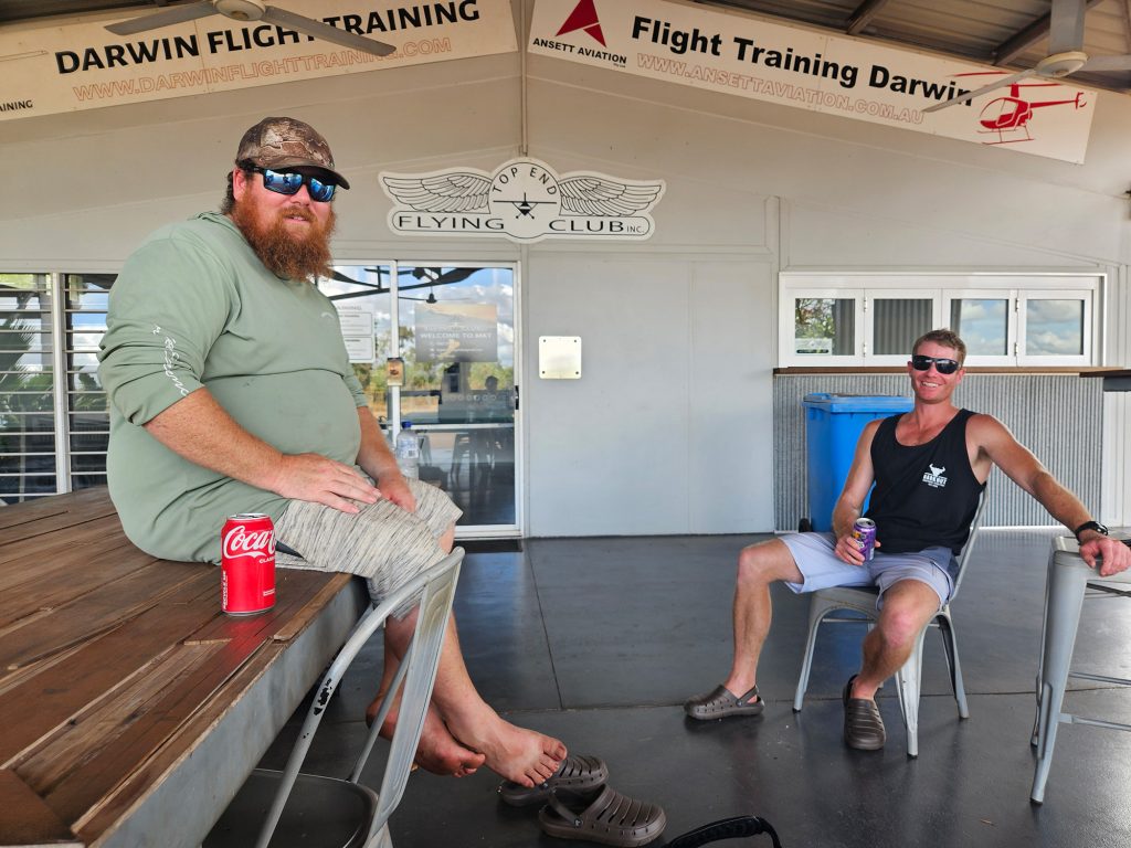
Darwin has an international airport, but just to the southeast is Emkaytee – the right sort of place for the light aircraft crowd. Between Darwin International and the RAAF there’s a whole lotta airspace to avoid and Emkaytee let’s you do exactly that. It’s a little bit of a ride in an Uber – like half an hour-ish – into town but what a nice little strip! Home to the Top End Flying Club and The Toy Box which had a nice display of aircraft out for maintenance. I had tied down the aircraft and was just wondering about ordering a taxi when an R44 came in and settled just behind me. It contained two lads from South Australia who had been using the chopper to go fishing in remote waterholes. Nice work if you can get it! We agreed to share a ride, and they dropped me in to town.
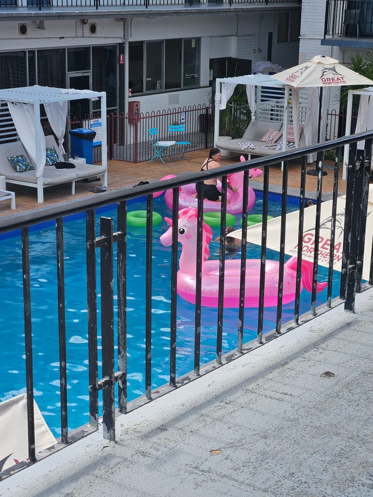
After my recent accommodation betting plunge, I had a keen eye for a bargain and the Cavanaugh Hotel looked just the ticket where three nights would cost me less than my previous night’s accommodation. I probably should have investigated that a bit more. A small red flag was that the pool was filled with inflatable unicorns, and the accommodation was joined to the pub part by a large open-air bar. My suspicions were confirmed when the DJ – and this is a Monday night – started droppin’ tunes at sundown and was still going strong when I dug out the foamy earplugs from Betoota and put myself to bed early – having had a long day. Darwin would be the only two-day break of the trip and provided the opportunity to do some laundry and catch up on work, meetings and emails. Tuesday night proved no different and the tunes were rolling strong by dusk. I was in a much better mood and joined the throng for a few quiet drinks. Food is Darwin’s strong point and the Asian influence has gone a long way to creating a thriving foodie scene. Wednesday night turned out to be State of Origin (NRL) night. And the whole town just went off. A Queensland win ensured a buoyant atmosphere and I was a little disappointed that I had to make an early start and couldn’t embrace the evening as fully as possible. God knows what that place would be like on a Friday, but I hadn’t the time or the liver capacity to find out.
I’d used the rest days to get some more detail into my planning for the rest of the trip. Between weather and the vagaries of light aviation, I tend to leave things a bit loosey goosey to avoid disappointment. I was originally planning to drop in next to Drysdale River Roadhouse in the Kimberley. Remember that rain event a couple of days ago as I came out of Gove? Well, it had hit the Kimberley hard and they’d had 60mm of rain in the preceding few days. The bloke I spoke to at Drysdale seemed a bit unsure about the state of the strip. Not good. I had a look at the touring guide and saw Mt Elizabeth Station just a bit further along toward Derby on the Gibb River Road. A quick call confirmed the strip was good – the Royal Flying Doctor Service had been in the day before to pick someone up – there was a bed available, there was food. Sounded perfect to me.
Heading out from Emkaytee, the flight would fly coastal over the Joseph Bonaparte Gulf which sits between the NT and WA and is really just a fancy name for the close bit of the Timor Sea. First, I had to duck south to avoid some airspace that the military had decided urgently needed blowing up or something so it had gone red on the map. I dunno. Best given a wide berth. That put me over Daly River by mid-morning before going feet-wet near Wadeye to cut the corner where the Victoria River enters the Gulf. I was quite happy to get back over dryish land at the mouth of the Ord. I say mouth, but the mouth of the Ord is so big (20km across) that it gets called the Gulf of Cambridge. It is hard to appreciate the scale here. At one point I saw a boat moving down the Ord River. As I got closer I realised it was a fullsized ship, which meant the river had to be about 2km wide at that point. Away to the south of me out of view, past Kununurra, was Lake Argyle, where a man-made lake capturing the water of the Ord has a freshwater storage 18 times the size of Sydney Harbour. They don’t muck around up here, do they? The scale of the country just highlights how few people are in the area. Settlements were few and far between – as were possible landing sites in case of issues. As always in overwater flying, I’m reminded of the part in the rules where it talks about being “less than 25 miles from a landing site”. I guess everything is a landing site if you have no choice, but still…
There was still a niggling doubt about what the landing strip at Mt Elizabeth Station might look like, so I was curious to say the least. As I approached what the GPS said was the location for the field, I couldn’t see afield. Oh well, I headed for the homestead then it looked like the airfield was to the SE on the map. Nope. Momentary confusion. Am I the right place? Am I holding the map upside down? Nope. Ok, what’s that suspiciously airstrip looking thing to the northeast? Yup. There it is. So, if you’re going to Mt Elizabeth Station – and there are many reasons to go, as I will detail – then know that the dotted circle saying YMTZ is in the wrong spot. The ERSA says 16°26’00.0”S 126°06’00.0”E. Whereas a quick check on Google Maps suggests it’s more like 16° 24’ 4.78”S 126° 6’ 52.85E. So, I’m calling shenanigans on the ERSA figures. I note the 250k topo looks wrong too.
Or am I wrong? Could someone who has a better brain for these things prove me right or wrong please. If I’m right, we can both have a credit for fixing the ERSA. Well, one bit of the ERSA…
The airstrip proved to be – and this is a technical term – freakin’ enormous. Like almost 2km long and most of a hundred metres wide. OK, I can hear you wondering how I couldn’t see it when I was in the wrong spot, but in my defence, I was 5km away and facing the wrong way and anyway, shutup. I just couldn’t, ok? As for softness, it was definitely at the softer end of the scale, but a good coating of grass was holding it together. Shortly after I pulled up a Landcruiser Ute arrived so I was saved the walk. Just as well because sections of the track were still a quagmire of puddles. Safely at the homestead with unmuddied tootsies, I met the team and was shown the big dining area/bar/ lawn and found my room in one of the nicer dongas I’d stayed in recently. Suitably refreshed, I joined the visitors – who were quite numerous – for a drink before dinner. Turns out they had all been stuck there for three days because the recent rains shut the Gibb River Road in both directions. Boy, were they happy to see a new face. Every dinner features beef from the Mt Elizabeth Station operation and it was superb. As it turned out, the group that I sat with included the lady whose husband had the medical emergency that necessitated the Royal Flying Doctor Service coming in the day before. She was now stuck there and having to get to Perth to the hospital and at the same time dealing with the fact she had a large 4WD that she wasn’t confident driving to get to Broome. Fortunately, amongst the group had been a doctor and someone who volunteered to drive her 4WD out for her. The bush community is still alive and well.
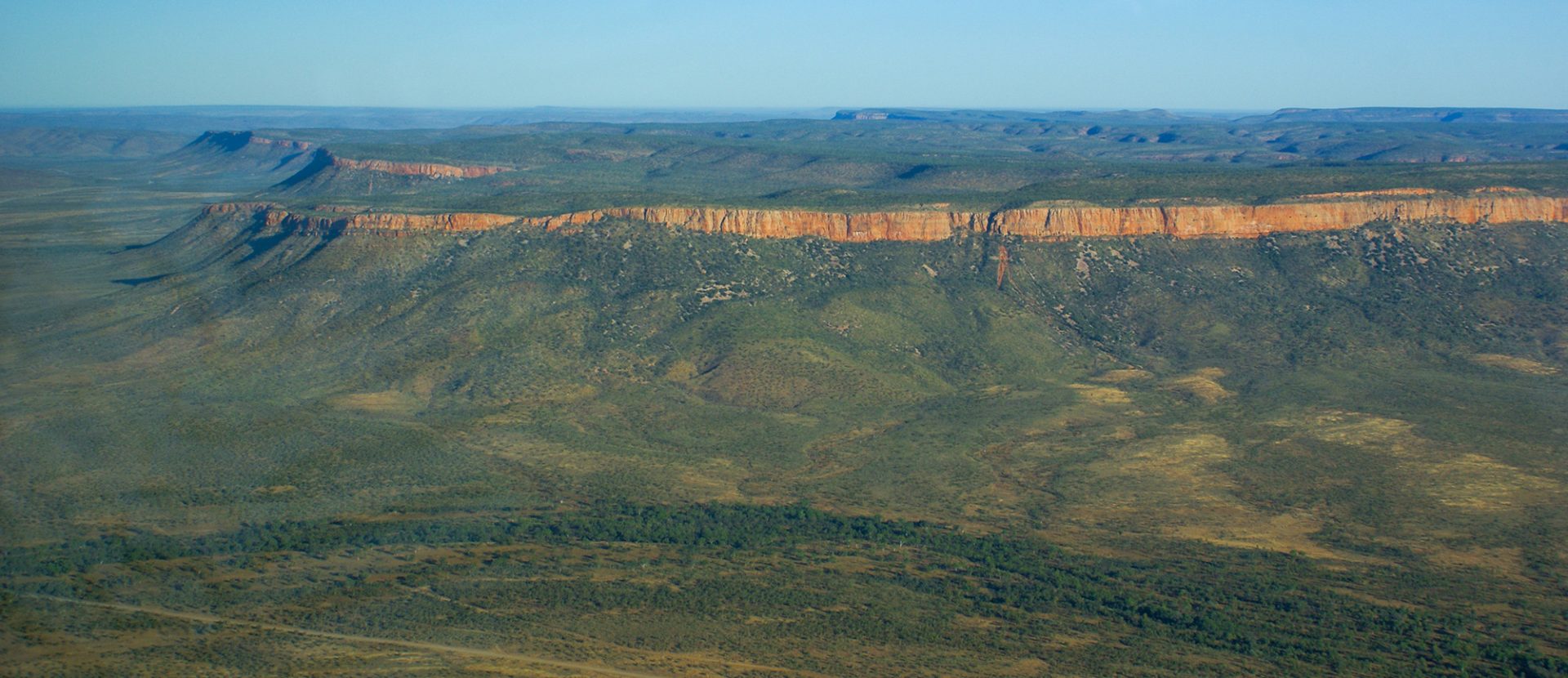
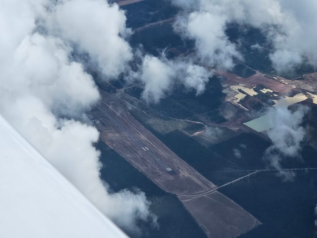
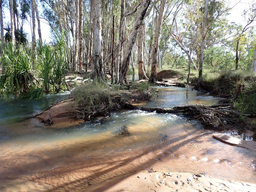
I spent the next day walking down to the nearby waterhole – which was flowing strongly – and alternately dipping in the pools and sitting on the bank watching the birdlife flutter about. Someone’s got to do it. If you want a destination in the Kimberley, this is it. Following a local beef pie for lunch and delicious beef again for dinner, my colon at least was pleased to be heading out again the next morning attached to the rest of me. What followed was going to be the most boring section of my journey, but yet again I was blown away by the ranges and features of the outback. The late wet season was definitely helping. Running low down the gorge out of Mt Elizabeth I could see cataracts and waterfalls, then the ground dropped away as I crossed the gorge proper – which is several miles wide. This is what flying should be. Less than an hour later I dropped in to Halls Creek for fuel. The upside-down car in the parking lot made me glad I hadn’t spent the night there. The ARO had to come and unlock the bowser for me because it was kept locked for good reasons. Not great. I then set out to follow roughly the Tanami Track to its starting place. There is so much to see out there. If you haven’t been, go. The pictures don’t do it justice.
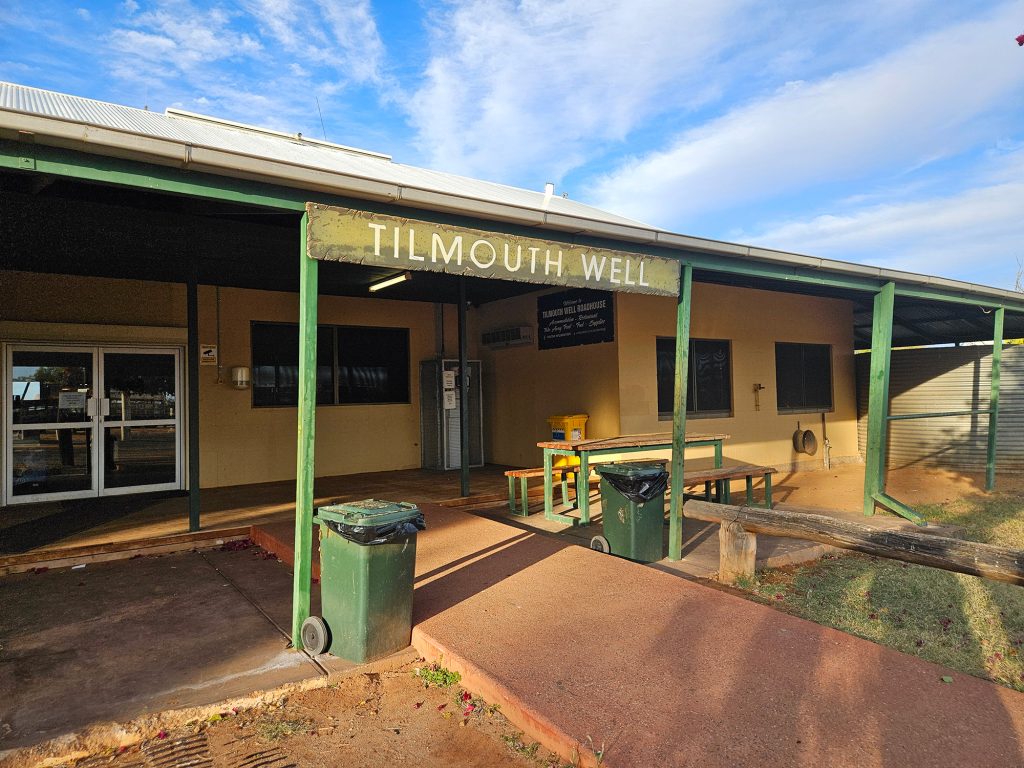
I had chosen to stop in Tilmouth Well Roadhouse, because my next stop would be Ayers Rock. And before you say it, Ayers Rock is still the name of the Airport. Uluru is the Rock. Anyhoo… that would require staying at a resort, which was verboten under my trip rules, so Tilmouth Well served the purpose, except they didn’t have AVGAS. I had rung and enquired about the state of the strip and been told it was pretty good. I guess I should have asked what that meant in more detail because a precautionary pass showed some darkish patches that look soft. Fortunately, there was enough runway to work beside them. Just as well I did because they were VERY soft as I discovered when I turned around on the strip and almost got stuck. Taking off would be tomorrow me’s problem to figure out.
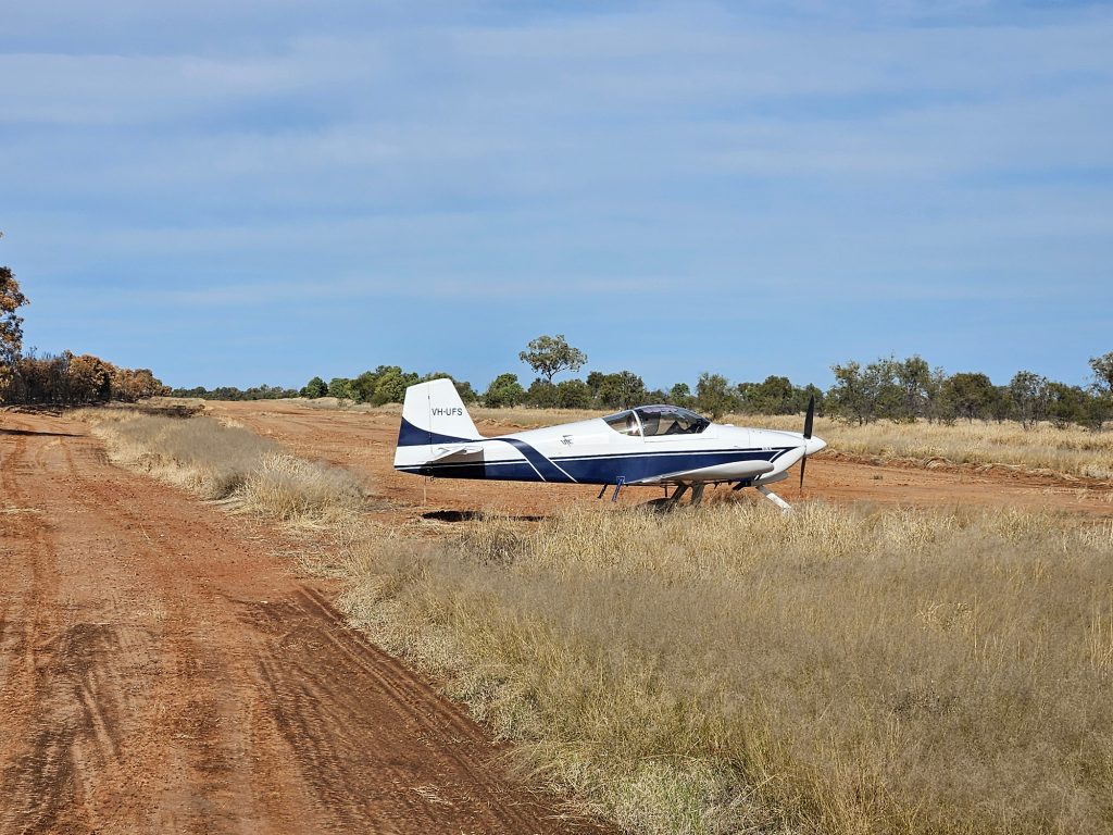
Tomorrow me was suitably unimpressed. So much so, that I walked 300 metres of the strip to pick a path that avoided the softest parts. If I started left, eased right, then centred it up, everything should be just fine… Did I mention I don’t have a steerable nose wheel?
And you don’t want to use brakes on a soft clay field and there’s no rudder authority to speak of below 30 knots? No? Well, I was acutely aware as I rolled on a combo short/soft/obstacle course take-off technique. #sweatingbullets. It worked, but I’m not proud of it.
A 90-minute hop to the Rock for fuel and then we would head to William Creek. But before we could do that, we would have to deal with a small issue. Note to self: when filling from the hi-flow AVGAS pump at Ayers Rock, which doesn’t have an auto-cut off, the reserve tank will fill really quickly and spray several litres of fuel in the cabin when it overfills. Now I know. Cue long shot: Sweaty pilot, dragging his fuel soaked and unsafe-to-start aircraft to the GA parking area, then emptying every single item out on to the wing so it could all dry out while he went and had lunch in the terminal. Sigh. Following all the fun and games, the trip to William Creek was uneventful, if still a little fumy. If you’re going to drop in to Ayers Rock – and every pilot should – then make sure you read up on local procedures and send them a pre-arrival request.
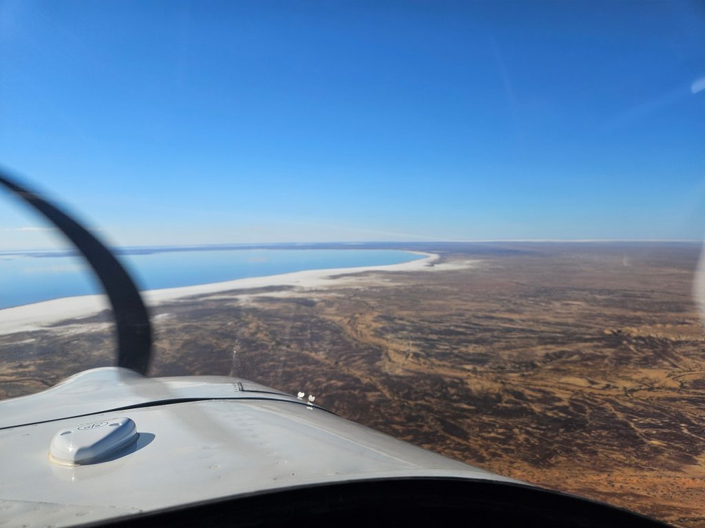
William Creek is run by a pilot, for pilots. Trevor Wright is the owner of everything he surveys there. The hotel, the planes, the lot. I was lucky to catch up with him in the hangar where he had Cessna Caravans and 210s parked next to a couple of RVs which he flies for fun. This was a pilots’ pilot. We chatted about the operation there – which is big and then I had dinner with 28 couples from the Lotus Caravan Club who were off on their annual tour. But the real reason I was at William Creek was that the next day I would fly across Lake Eyre. I was up early – well, early for me – and headed out toward Lake Eyre which was just about full. The wind was almost non-existent, so Lake Eyre was like glass. The low sun almost blinding in reflection. I traversed just the southern end. It would take many hours to go round it. It’s the sort of sight you won’t forget.
The last job was to grab some fuel in Renmark and head home. Like every airport I land at, there’s no radio chatter for 20 minutes as I approach then just as I get ready to transmit my inbound, every training organisation in the state and some guy planning a 50 mile straight in gets on the radio. That frustration aside, Renmark had fuel and a rest stop. Just what I needed as I ate my last lunch on the road. That tailwind I had enjoyed on the way up was expected to penalise me on the way home, but lo and behold, we picked up a 10-knot tailwind. As a result, we came past Bendigo at 160 knots and were home, tucked back in the hangar at Lethbridge before ETA.
So, did what did I learn? I learnt that every bit of Australia is worth seeing. That the people you meet make all the hard work worthwhile and that as a private pilot I am privileged to see wonderous things that most people will never get to see. Oh, and make sure you preload your podcasts, because there’s no service out there. All important life lessons.