THE ART OF NAVIGATING WEATHER
A day late and a day early bookended the trip to Parkes for the inaugural Fly ’n for Fun, the first of the big friendly fly ins since the fog of COVID-19 kept most aviators close to home.
We began a day late as QLD was still shaking off a second sub-tropical low that made VFR navigation impossible, and made the poor folk of Lismore weep again for their flood sodden town.
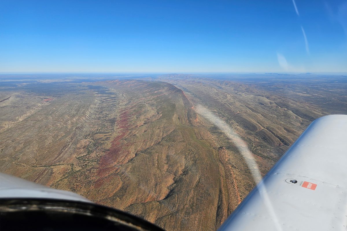
Like a lot of pilots, it had been a while since I had done more than a 50 nautical sortie. Flying across two states, two FIRs and numerous weather systems meant some thorough planning was needed. The plan was to stay west to avoid the influence of the monster low that was battering the whole east coast of NSW. That would take us via Moree, Coonabarabran, Dubbo and eventually Parkes. This worked, except that the typical convection from coastal moisture and 20kn southerlies had whipped up some big CUs in a band from Manilla almost to Warren. Was it just a line or was it thickening as we headed south? Radar and updated weather reports didn’t shed any light, so our 6,500 ft level was going to need consideration. Over or under; the perennial question for pilots!
We tried over first. This worked for a while at 8,500 ft but – like a badly poured beer – they had some big heads on them. Chasing canyons in the sky may be fun, but when you’re on a plan and you can’t see the forest for the trees this didn’t work for too long. We looked for a clear path but none was found on top. Down elevator please. Back at 4,500 ft, we found the bumps weren’t bad so we persisted, pointing the trusty Sling south.
We could see the curtain of the weather show on the ranges behind the central coast as we edged closer to Parkes and thought of all those pilots who must have been contemplating departures into uncertain conditions. While we had a trip of just over 450nm from notso-sunny QLD, at least the great divide was not the gauntlet our NSW friends would be running.
Parkes was run and done, a great event to shout “we’re back baby!” to the aviation community. Our original plans were to return Monday, but the weather was talking to us and we listened. One key skill a pilot must develop is the ability to visualise the GAF and draw a 3D picture of the weather and its changes. Area twenty had a divided story; nice in the south but a nasty visitor building over the northwest. I relayed my expectations to my fellow work colleagues. Despite always enjoying their company, it was time to go.
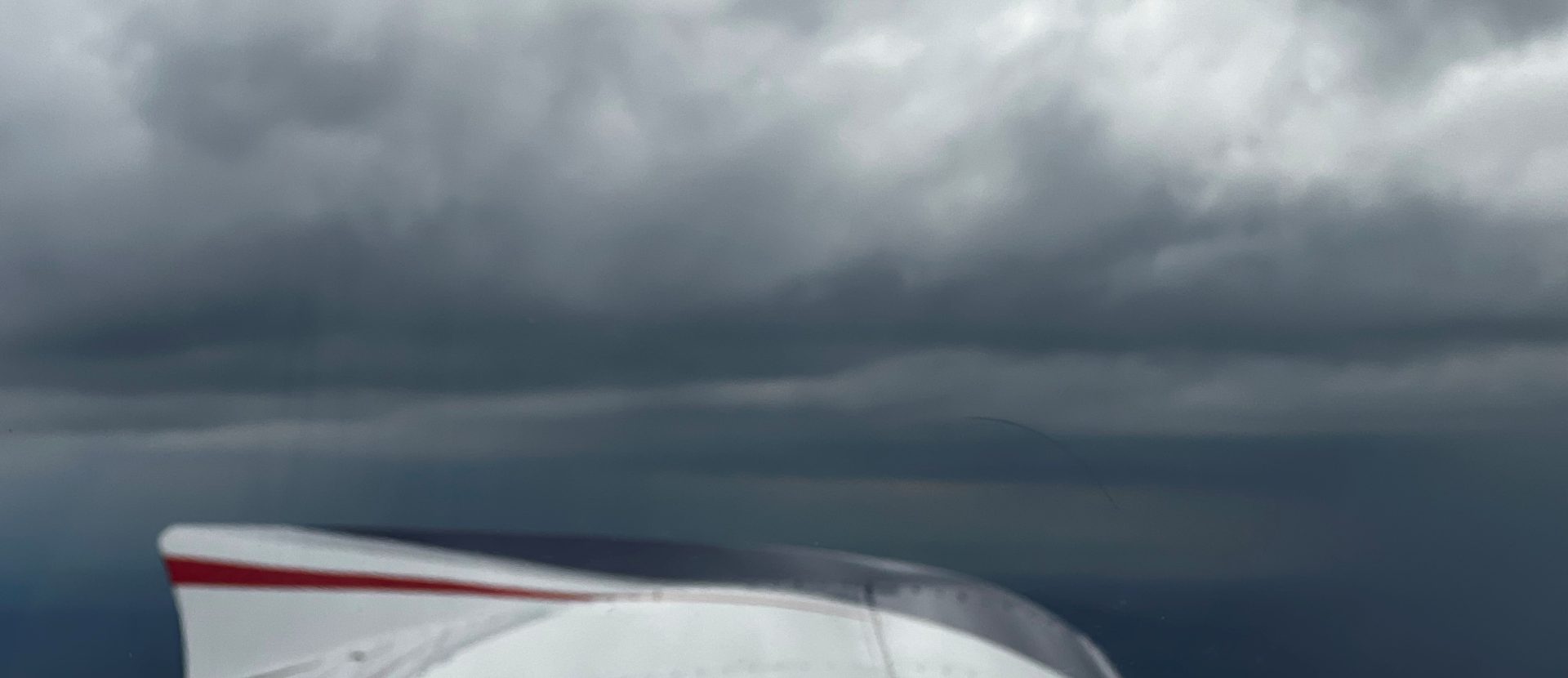
Weather can be like a prize fighter; a nimble featherweight throwing lightning punches, or a fearful heavyweight towering down, building, waiting for you to make one mistake and bang! Lights out. Today was a combination of both, with parrying showers, menacing stratus and towering CUs building, waiting and hiding as we departed a lovely Gunnedah sky enroute for Warwick.
I know this area well. I’ve been flying sailplanes, aeroplanes and paragliders around the northwest slopes and plains since I was fifteen. Local knowledge helps a lot; today was not the day to pick a fight. Information is essential in decision-making, but information alone won’t solve the puzzle. It was clear the main line of deteriorating weather was running from Moree in the west to the high country in the east. It hadn’t yet pushed through the Upper Horton Valley, but it was coming. Time to consider each move carefully. My view is that the most important decision is an early one. It’s served me well, having watched others perish due to bad weather decisions on the same track I was flying, listening to others boast how they flew IFR (I Follow Roads) as they scud run their way home.
I put these disciplines into practice. Small steps; assessing what was compromised, what was safe and the clear alternatives, never dismissing that most important back door exit. We were winning against the rain band, but only just. It’s tempting to speed up in these circumstances, but slowing down is sometimes the better option so you can process what is going on around you. A planned deviation to Inglewood was first. Facing forward, the game of objectivity continued – was the base holding? Was there clear sun ahead? OzRunways said it was clear ahead and confirmed the worst was behind us on a SE track.
Experience can be a cruel teacher; it often gives you the test first and the lesson later. We passed the test, Ashford came up on our left while we descended temporarily to 4,500 ft. Texas was soon on our nose in clearer skies. A long look back showed Inverell now being blanketed in rain.
We arrived home safe and with a worthy tale to tell in the hope others may contemplate the importance of planning, understanding and interpreting the fifty plus shades of grey that weather can present in any crosscountry flight.